You are here: Home > Network List > IW - Intermountain West Stations List
> Station DLMT Dillon, Montana, USA > Earthquake Result Viewer
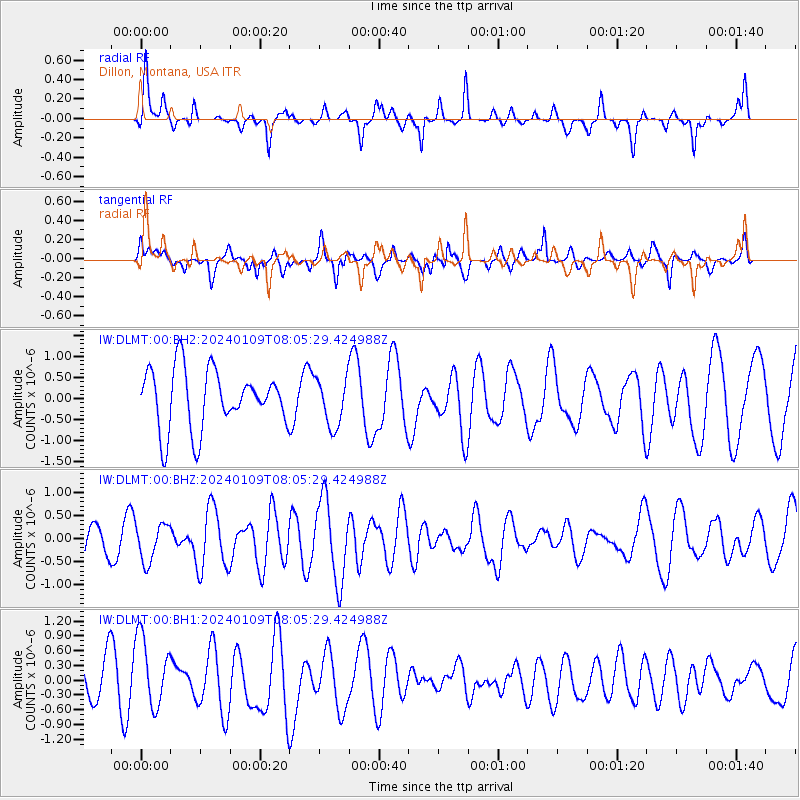
DLMT Dillon, Montana, USA - Earthquake Result Viewer
*The percent match for this event was below the threshold and hence no stack was calculated.
| Earthquake location: |
Tonga Islands |
| Earthquake latitude/longitude: |
-20.9/-173.6 |
| Earthquake time(UTC): |
2024/01/09 (009) 07:53:20 GMT |
| Earthquake Depth: |
10 km |
| Earthquake Magnitude: |
5.7 mww |
| Earthquake Catalog/Contributor: |
NEIC PDE/us |
|
| Network: |
IW Intermountain West |
| Station: |
DLMT Dillon, Montana, USA |
| Lat/Lon: |
45.36 N/112.60 W |
| Elevation: |
1569 m |
|
| Distance: |
86.1 deg |
| Az: |
38.166 deg |
| Baz: |
235.05 deg |
| Ray Param: |
$rayparam |
*The percent match for this event was below the threshold and hence was not used in the summary stack. |
|
| Radial Match: |
45.498802 % |
| Radial Bump: |
281 |
| Transverse Match: |
40.554935 % |
| Transverse Bump: |
400 |
| SOD ConfigId: |
33437571 |
| Insert Time: |
2024-01-23 08:07:05.821 +0000 |
| GWidth: |
2.5 |
| Max Bumps: |
400 |
| Tol: |
0.001 |
|
Signal To Noise
| Channel | StoN | STA | LTA |
| IW:DLMT:00:BHZ:20240109T08:05:29.424988Z | 1.1456896 | 4.0318977E-7 | 3.5191883E-7 |
| IW:DLMT:00:BH1:20240109T08:05:29.424988Z | 1.2164325 | 7.455512E-7 | 6.128998E-7 |
| IW:DLMT:00:BH2:20240109T08:05:29.424988Z | 0.81399405 | 5.726672E-7 | 7.035275E-7 |
| Arrivals |
| Ps | |
| PpPs | |
| PsPs/PpSs | |


