You are here: Home > Network List > CN - Canadian National Seismograph Network Stations List
> Station INK INUVIK, NT > Earthquake Result Viewer
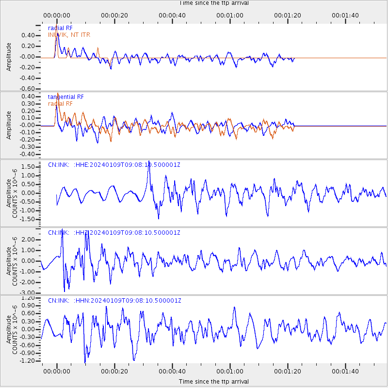
INK INUVIK, NT - Earthquake Result Viewer
*The percent match for this event was below the threshold and hence no stack was calculated.
| Earthquake location: |
Near West Coast Of Honshu, Japan |
| Earthquake latitude/longitude: |
37.9/137.7 |
| Earthquake time(UTC): |
2024/01/09 (009) 08:59:10 GMT |
| Earthquake Depth: |
11 km |
| Earthquake Magnitude: |
5.8 Mww |
| Earthquake Catalog/Contributor: |
NEIC PDE/us |
|
| Network: |
CN Canadian National Seismograph Network |
| Station: |
INK INUVIK, NT |
| Lat/Lon: |
68.31 N/133.53 W |
| Elevation: |
44 m |
|
| Distance: |
55.0 deg |
| Az: |
26.992 deg |
| Baz: |
284.963 deg |
| Ray Param: |
$rayparam |
*The percent match for this event was below the threshold and hence was not used in the summary stack. |
|
| Radial Match: |
58.74488 % |
| Radial Bump: |
400 |
| Transverse Match: |
58.818295 % |
| Transverse Bump: |
400 |
| SOD ConfigId: |
33437571 |
| Insert Time: |
2024-01-23 09:15:22.700 +0000 |
| GWidth: |
2.5 |
| Max Bumps: |
400 |
| Tol: |
0.001 |
|
Signal To Noise
| Channel | StoN | STA | LTA |
| CN:INK: :HHZ:20240109T09:08:10.500001Z | 3.3570294 | 1.4687226E-6 | 4.3750666E-7 |
| CN:INK: :HHN:20240109T09:08:10.500001Z | 0.77197665 | 2.824997E-7 | 3.6594332E-7 |
| CN:INK: :HHE:20240109T09:08:10.500001Z | 2.7636218 | 7.363417E-7 | 2.6644082E-7 |
| Arrivals |
| Ps | |
| PpPs | |
| PsPs/PpSs | |


