INU Inuyama, Japan - Earthquake Result Viewer
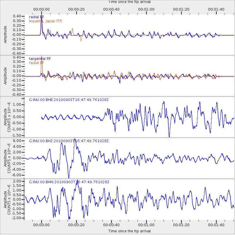
Earthquake location: South Island, New Zealand
Earthquake latitude/longitude: -43.5/171.8
Earthquake time(UTC): 2010/09/03 (246) 16:35:47 GMT
Earthquake Depth: 12 km
Earthquake Magnitude: 6.4 MB, 7.3 MS, 7.0 MW, 7.0 MW
Earthquake Catalog/Contributor: WHDF/NEIC
Network: G GEOSCOPE
Station: INU Inuyama, Japan
Lat/Lon: 35.35 N/137.03 E
Elevation: 132 m
Distance: 84.7 deg
Az: 332.058 deg
Baz: 155.357 deg
Ray Param: 0.04531888
Estimated Moho Depth: 51.75 km
Estimated Crust Vp/Vs: 2.09
Assumed Crust Vp: 6.461 km/s
Estimated Crust Vs: 3.088 km/s
Estimated Crust Poisson's Ratio: 0.35
Radial Match: 92.83928 %
Radial Bump: 400
Transverse Match: 84.769325 %
Transverse Bump: 400
SOD ConfigId: 319893
Insert Time: 2011-01-13 07:39:07.189 +0000
GWidth: 2.5
Max Bumps: 400
Tol: 0.001

Signal To Noise

ChannelStoNSTALTA
G:INU:00:BHZ:20100903T16:47:49.761028Z10.6888191.379897E-61.2909723E-7
G:INU:00:BHN:20100903T16:47:49.761028Z2.58090264.0661976E-71.5754944E-7
G:INU:00:BHE:20100903T16:47:49.761028Z1.02287611.1584967E-71.1325875E-7
Arrivals
Ps8.9 SECOND
PpPs24 SECOND
PsPs/PpSs33 SECOND