PATS 6onpei, Micronesia - Earthquake Result Viewer
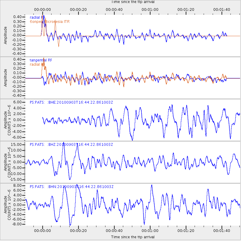
Earthquake location: South Island, New Zealand
Earthquake latitude/longitude: -43.5/171.8
Earthquake time(UTC): 2010/09/03 (246) 16:35:47 GMT
Earthquake Depth: 12 km
Earthquake Magnitude: 6.4 MB, 7.3 MS, 7.0 MW, 7.0 MW
Earthquake Catalog/Contributor: WHDF/NEIC
Network: PS Pacific21
Station: PATS 6onpei, Micronesia
Lat/Lon: 6.84 N/158.32 E
Elevation: 10 m
Distance: 51.6 deg
Az: 342.776 deg
Baz: 167.472 deg
Ray Param: 0.06730459
Estimated Moho Depth: 12.0 km
Estimated Crust Vp/Vs: 1.60
Assumed Crust Vp: 4.24 km/s
Estimated Crust Vs: 2.646 km/s
Estimated Crust Poisson's Ratio: 0.18
Radial Match: 85.775986 %
Radial Bump: 400
Transverse Match: 74.504265 %
Transverse Bump: 400
SOD ConfigId: 319893
Insert Time: 2011-01-13 07:40:22.764 +0000
GWidth: 2.5
Max Bumps: 400
Tol: 0.001

Signal To Noise

ChannelStoNSTALTA
PS:PATS: :BHZ:20100903T16:44:22.861003Z2.40467432.1504193E-68.942663E-7
PS:PATS: :BHN:20100903T16:44:22.861003Z0.72773057.384349E-71.0147093E-6
PS:PATS: :BHE:20100903T16:44:22.861003Z2.3343751.3524685E-65.7937075E-7
Arrivals
Ps1.8 SECOND
PpPs7.2 SECOND
PsPs/PpSs8.9 SECOND