You are here: Home > Network List > US - United States National Seismic Network Stations List
> Station MNTX Cornudas Mountains, Texas, USA > Earthquake Result Viewer
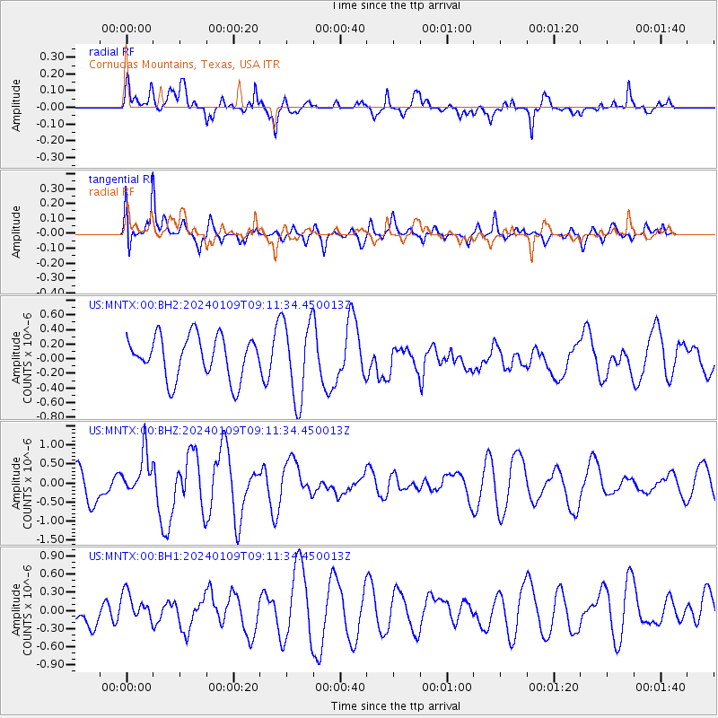
MNTX Cornudas Mountains, Texas, USA - Earthquake Result Viewer
*The percent match for this event was below the threshold and hence no stack was calculated.
| Earthquake location: |
Near West Coast Of Honshu, Japan |
| Earthquake latitude/longitude: |
37.9/137.7 |
| Earthquake time(UTC): |
2024/01/09 (009) 08:59:10 GMT |
| Earthquake Depth: |
11 km |
| Earthquake Magnitude: |
5.8 Mww |
| Earthquake Catalog/Contributor: |
NEIC PDE/us |
|
| Network: |
US United States National Seismic Network |
| Station: |
MNTX Cornudas Mountains, Texas, USA |
| Lat/Lon: |
31.70 N/105.38 W |
| Elevation: |
405 m |
|
| Distance: |
89.2 deg |
| Az: |
49.48 deg |
| Baz: |
315.108 deg |
| Ray Param: |
$rayparam |
*The percent match for this event was below the threshold and hence was not used in the summary stack. |
|
| Radial Match: |
60.56177 % |
| Radial Bump: |
386 |
| Transverse Match: |
57.31376 % |
| Transverse Bump: |
400 |
| SOD ConfigId: |
33437571 |
| Insert Time: |
2024-01-23 09:32:42.368 +0000 |
| GWidth: |
2.5 |
| Max Bumps: |
400 |
| Tol: |
0.001 |
|
Signal To Noise
| Channel | StoN | STA | LTA |
| US:MNTX:00:BHZ:20240109T09:11:34.450013Z | 1.6187642 | 5.6183444E-7 | 3.4707617E-7 |
| US:MNTX:00:BH1:20240109T09:11:34.450013Z | 0.75144047 | 2.3522173E-7 | 3.1302778E-7 |
| US:MNTX:00:BH2:20240109T09:11:34.450013Z | 1.8931414 | 5.411541E-7 | 2.858498E-7 |
| Arrivals |
| Ps | |
| PpPs | |
| PsPs/PpSs | |


