You are here: Home > Network List > UU - University of Utah Regional Network Stations List
> Station CCUT Cedar City, UT, USA > Earthquake Result Viewer
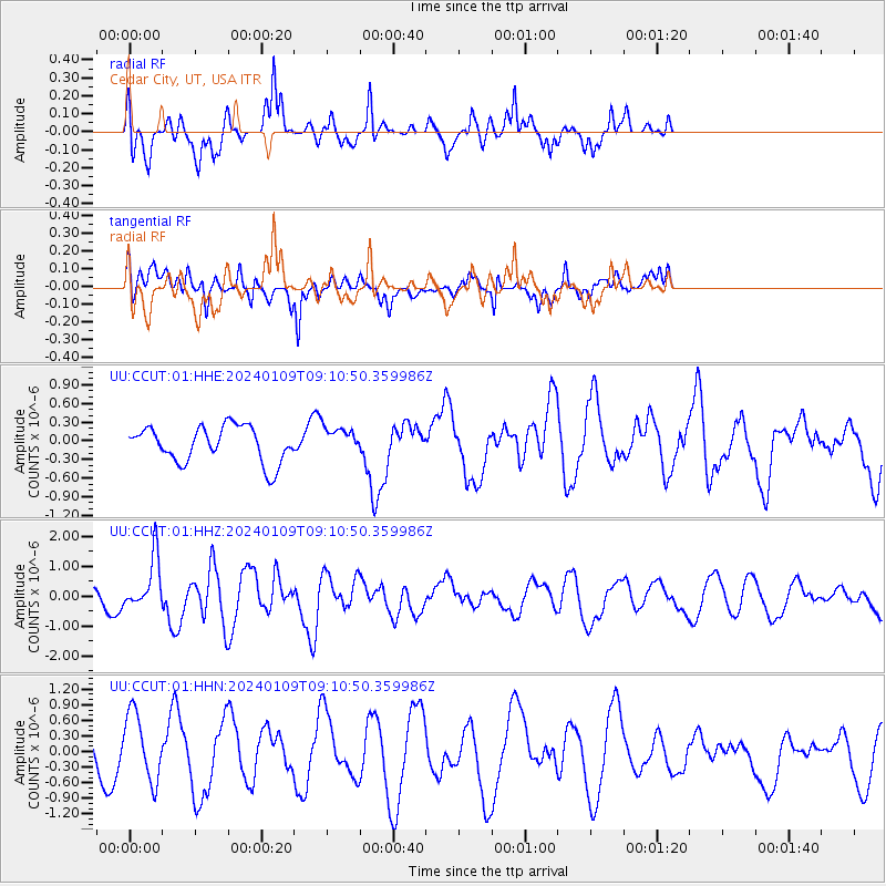
CCUT Cedar City, UT, USA - Earthquake Result Viewer
*The percent match for this event was below the threshold and hence no stack was calculated.
| Earthquake location: |
Near West Coast Of Honshu, Japan |
| Earthquake latitude/longitude: |
37.9/137.7 |
| Earthquake time(UTC): |
2024/01/09 (009) 08:59:10 GMT |
| Earthquake Depth: |
11 km |
| Earthquake Magnitude: |
5.8 Mww |
| Earthquake Catalog/Contributor: |
NEIC PDE/us |
|
| Network: |
UU University of Utah Regional Network |
| Station: |
CCUT Cedar City, UT, USA |
| Lat/Lon: |
37.55 N/113.36 W |
| Elevation: |
2127 m |
|
| Distance: |
80.4 deg |
| Az: |
49.686 deg |
| Baz: |
310.602 deg |
| Ray Param: |
$rayparam |
*The percent match for this event was below the threshold and hence was not used in the summary stack. |
|
| Radial Match: |
61.383984 % |
| Radial Bump: |
337 |
| Transverse Match: |
73.75658 % |
| Transverse Bump: |
400 |
| SOD ConfigId: |
33437571 |
| Insert Time: |
2024-01-23 09:33:04.930 +0000 |
| GWidth: |
2.5 |
| Max Bumps: |
400 |
| Tol: |
0.001 |
|
Signal To Noise
| Channel | StoN | STA | LTA |
| UU:CCUT:01:HHZ:20240109T09:10:50.359986Z | 2.5627027 | 8.641142E-7 | 3.3718865E-7 |
| UU:CCUT:01:HHN:20240109T09:10:50.359986Z | 1.75283 | 6.5394E-7 | 3.730767E-7 |
| UU:CCUT:01:HHE:20240109T09:10:50.359986Z | 0.7776529 | 2.2331307E-7 | 2.8716292E-7 |
| Arrivals |
| Ps | |
| PpPs | |
| PsPs/PpSs | |


