You are here: Home > Network List > IC - New China Digital Seismograph Network Stations List
> Station ENH Enshi, Hubei Province, China > Earthquake Result Viewer
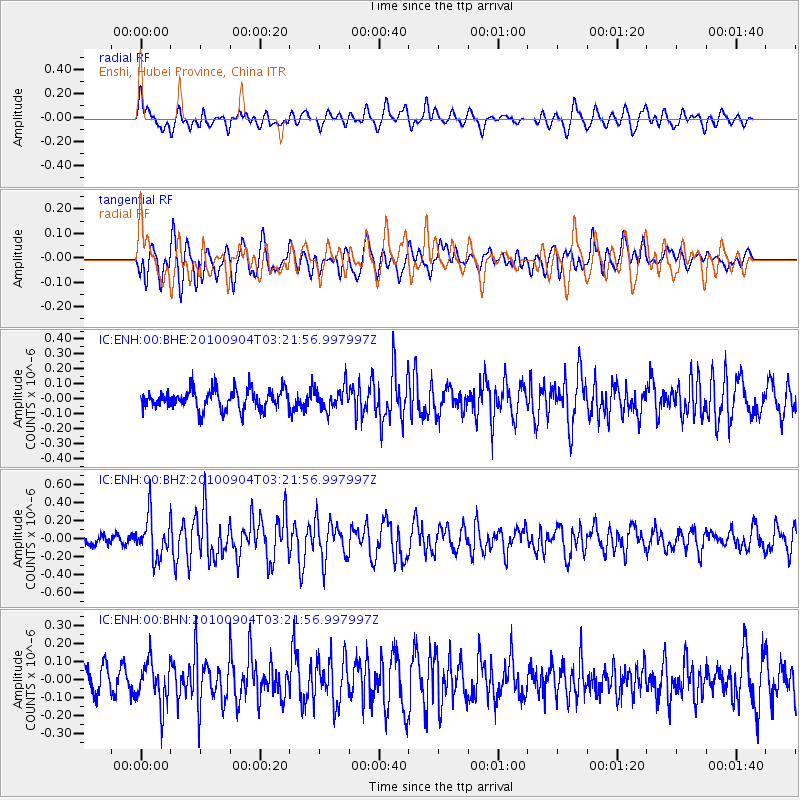
ENH Enshi, Hubei Province, China - Earthquake Result Viewer
*The percent match for this event was below the threshold and hence no stack was calculated.
| Earthquake location: |
Irian Jaya, Indonesia |
| Earthquake latitude/longitude: |
-2.5/138.5 |
| Earthquake time(UTC): |
2010/09/04 (247) 03:14:34 GMT |
| Earthquake Depth: |
44 km |
| Earthquake Magnitude: |
5.7 MB, 5.2 MS, 5.6 MW, 5.4 MW |
| Earthquake Catalog/Contributor: |
WHDF/NEIC |
|
| Network: |
IC New China Digital Seismograph Network |
| Station: |
ENH Enshi, Hubei Province, China |
| Lat/Lon: |
30.27 N/109.49 E |
| Elevation: |
487 m |
|
| Distance: |
42.7 deg |
| Az: |
321.846 deg |
| Baz: |
134.484 deg |
| Ray Param: |
$rayparam |
*The percent match for this event was below the threshold and hence was not used in the summary stack. |
|
| Radial Match: |
58.26825 % |
| Radial Bump: |
400 |
| Transverse Match: |
60.05129 % |
| Transverse Bump: |
400 |
| SOD ConfigId: |
319893 |
| Insert Time: |
2011-01-13 07:45:43.146 +0000 |
| GWidth: |
2.5 |
| Max Bumps: |
400 |
| Tol: |
0.001 |
|
Signal To Noise
| Channel | StoN | STA | LTA |
| IC:ENH:00:BHZ:20100904T03:21:56.997997Z | 2.5947793 | 2.2633279E-7 | 8.722622E-8 |
| IC:ENH:00:BHN:20100904T03:21:56.997997Z | 1.5507306 | 1.2019173E-7 | 7.750651E-8 |
| IC:ENH:00:BHE:20100904T03:21:56.997997Z | 1.1354619 | 7.467514E-8 | 6.576631E-8 |
| Arrivals |
| Ps | |
| PpPs | |
| PsPs/PpSs | |


