You are here: Home > Network List > CI - Caltech Regional Seismic Network Stations List
> Station MLAC Mammoth Lakes, California, USA > Earthquake Result Viewer
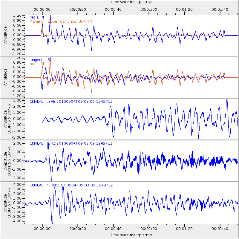
MLAC Mammoth Lakes, California, USA - Earthquake Result Viewer
*The percent match for this event was below the threshold and hence no stack was calculated.
| Earthquake location: |
Tonga Islands |
| Earthquake latitude/longitude: |
-17.4/-174.0 |
| Earthquake time(UTC): |
2010/09/04 (247) 08:52:04 GMT |
| Earthquake Depth: |
69 km |
| Earthquake Magnitude: |
5.9 MB, 6.1 MW, 6.0 MW |
| Earthquake Catalog/Contributor: |
WHDF/NEIC |
|
| Network: |
CI Caltech Regional Seismic Network |
| Station: |
MLAC Mammoth Lakes, California, USA |
| Lat/Lon: |
37.63 N/118.84 W |
| Elevation: |
2134 m |
|
| Distance: |
75.4 deg |
| Az: |
42.339 deg |
| Baz: |
234.108 deg |
| Ray Param: |
$rayparam |
*The percent match for this event was below the threshold and hence was not used in the summary stack. |
|
| Radial Match: |
76.737335 % |
| Radial Bump: |
400 |
| Transverse Match: |
64.482056 % |
| Transverse Bump: |
400 |
| SOD ConfigId: |
319893 |
| Insert Time: |
2011-01-13 07:53:41.992 +0000 |
| GWidth: |
2.5 |
| Max Bumps: |
400 |
| Tol: |
0.001 |
|
Signal To Noise
| Channel | StoN | STA | LTA |
| CI:MLAC: :BHZ:20100904T09:03:09.194971Z | 12.620448 | 8.676504E-7 | 6.874957E-8 |
| CI:MLAC: :BHN:20100904T09:03:09.194971Z | 2.873376 | 4.965722E-7 | 1.728184E-7 |
| CI:MLAC: :BHE:20100904T09:03:09.194971Z | 1.0300453 | 2.8530073E-7 | 2.7697885E-7 |
| Arrivals |
| Ps | |
| PpPs | |
| PsPs/PpSs | |


