You are here: Home > Network List > CI - Caltech Regional Seismic Network Stations List
> Station VES Vestal, Richgrove, CA, USA > Earthquake Result Viewer
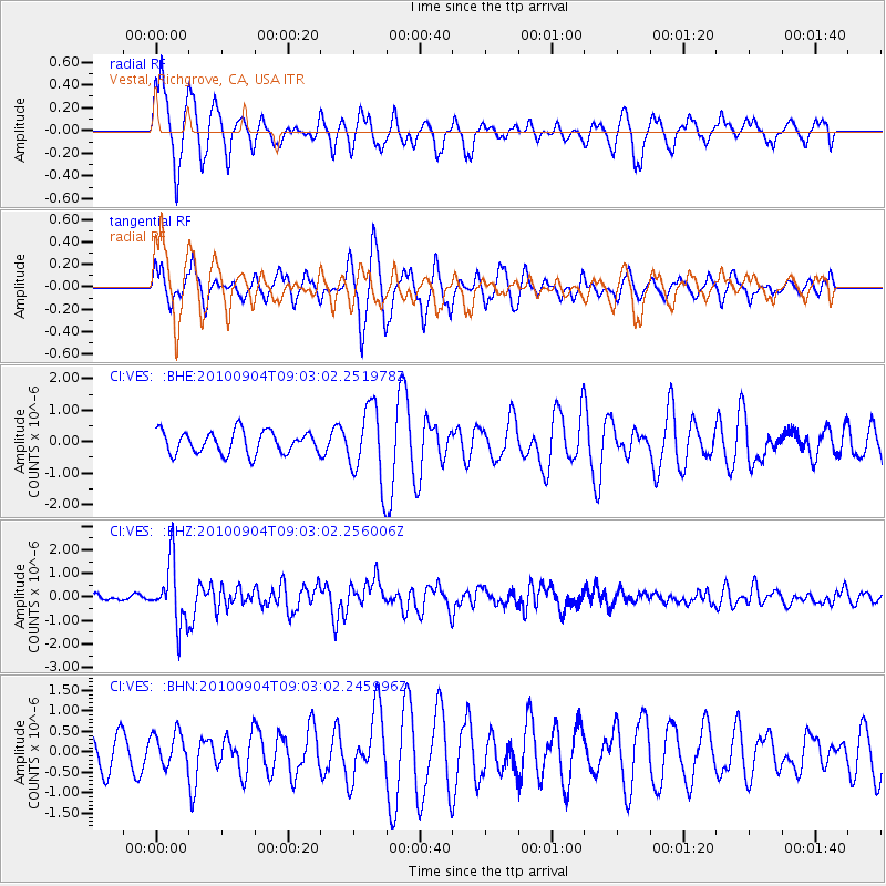
VES Vestal, Richgrove, CA, USA - Earthquake Result Viewer

| Earthquake location: |
Tonga Islands |
| Earthquake latitude/longitude: |
-17.4/-174.0 |
| Earthquake time(UTC): |
2010/09/04 (247) 08:52:04 GMT |
| Earthquake Depth: |
69 km |
| Earthquake Magnitude: |
5.9 MB, 6.1 MW, 6.0 MW |
| Earthquake Catalog/Contributor: |
WHDF/NEIC |
|
| Network: |
CI Caltech Regional Seismic Network |
| Station: |
VES Vestal, Richgrove, CA, USA |
| Lat/Lon: |
35.84 N/119.08 W |
| Elevation: |
154 m |
|
| Distance: |
74.2 deg |
| Az: |
43.72 deg |
| Baz: |
234.323 deg |
| Ray Param: |
0.052374523 |
| Estimated Moho Depth: |
13.75 km |
| Estimated Crust Vp/Vs: |
1.63 |
| Assumed Crust Vp: |
6.1 km/s |
| Estimated Crust Vs: |
3.737 km/s |
| Estimated Crust Poisson's Ratio: |
0.20 |
|
| Radial Match: |
85.054504 % |
| Radial Bump: |
367 |
| Transverse Match: |
70.219604 % |
| Transverse Bump: |
339 |
| SOD ConfigId: |
319893 |
| Insert Time: |
2011-01-13 07:54:28.259 +0000 |
| GWidth: |
2.5 |
| Max Bumps: |
400 |
| Tol: |
0.001 |
|
Signal To Noise
| Channel | StoN | STA | LTA |
| CI:VES: :BHZ:20100904T09:03:02.256006Z | 14.438001 | 1.2992368E-6 | 8.998732E-8 |
| CI:VES: :BHN:20100904T09:03:02.245996Z | 0.75382113 | 4.174104E-7 | 5.53726E-7 |
| CI:VES: :BHE:20100904T09:03:02.251978Z | 3.313261 | 1.1778095E-6 | 3.5548345E-7 |
| Arrivals |
| Ps | 1.5 SECOND |
| PpPs | 5.7 SECOND |
| PsPs/PpSs | 7.2 SECOND |


