You are here: Home > Network List > CI - Caltech Regional Seismic Network Stations List
> Station SMM Simmler, CA, USA > Earthquake Result Viewer
SMM Simmler, CA, USA - Earthquake Result Viewer
*The percent match for this event was below the threshold and hence no stack was calculated.
| Earthquake location: |
Tonga Islands |
| Earthquake latitude/longitude: |
-17.4/-174.0 |
| Earthquake time(UTC): |
2010/09/04 (247) 08:52:04 GMT |
| Earthquake Depth: |
69 km |
| Earthquake Magnitude: |
5.9 MB, 6.1 MW, 6.0 MW |
| Earthquake Catalog/Contributor: |
WHDF/NEIC |
|
| Network: |
CI Caltech Regional Seismic Network |
| Station: |
SMM Simmler, CA, USA |
| Lat/Lon: |
35.31 N/120.00 W |
| Elevation: |
599 m |
|
| Distance: |
73.2 deg |
| Az: |
43.709 deg |
| Baz: |
233.792 deg |
| Ray Param: |
$rayparam |
*The percent match for this event was below the threshold and hence was not used in the summary stack. |
|
| Radial Match: |
77.40846 % |
| Radial Bump: |
400 |
| Transverse Match: |
70.11476 % |
| Transverse Bump: |
400 |
| SOD ConfigId: |
319893 |
| Insert Time: |
2011-01-13 07:54:33.812 +0000 |
| GWidth: |
2.5 |
| Max Bumps: |
400 |
| Tol: |
0.001 |
|
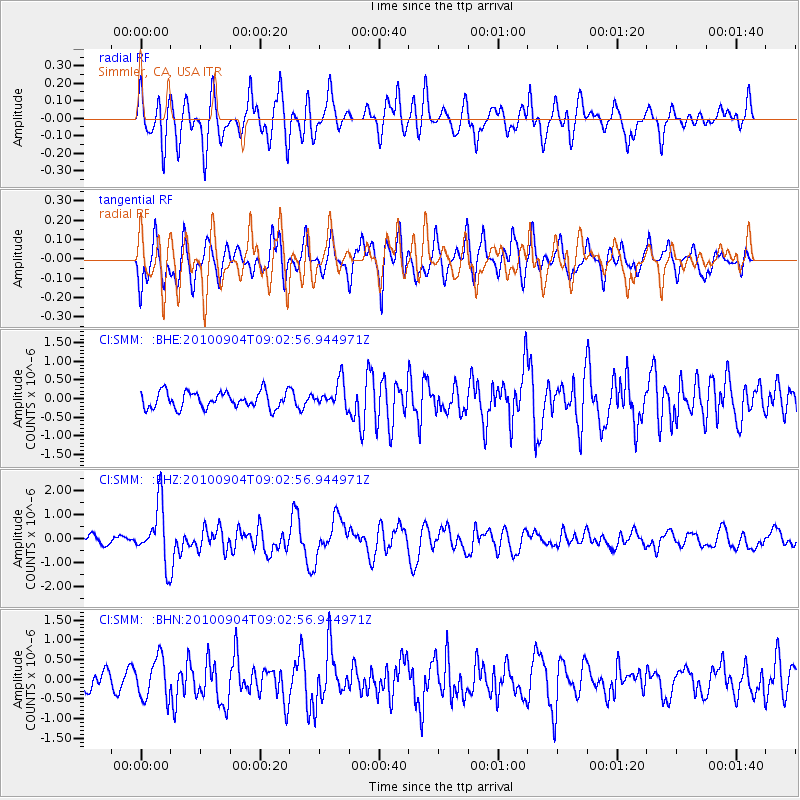
Signal To Noise
| Channel | StoN | STA | LTA |
| CI:SMM: :BHZ:20100904T09:02:56.944971Z | 4.1132746 | 1.1975211E-6 | 2.911357E-7 |
| CI:SMM: :BHN:20100904T09:02:56.944971Z | 2.7630775 | 5.1893863E-7 | 1.8781182E-7 |
| CI:SMM: :BHE:20100904T09:02:56.944971Z | 1.5851932 | 3.489566E-7 | 2.2013508E-7 |
| Arrivals |
| Ps | |
| PpPs | |
| PsPs/PpSs | |


