You are here: Home > Network List > CI - Caltech Regional Seismic Network Stations List
> Station MPP McPhearson Peak > Earthquake Result Viewer
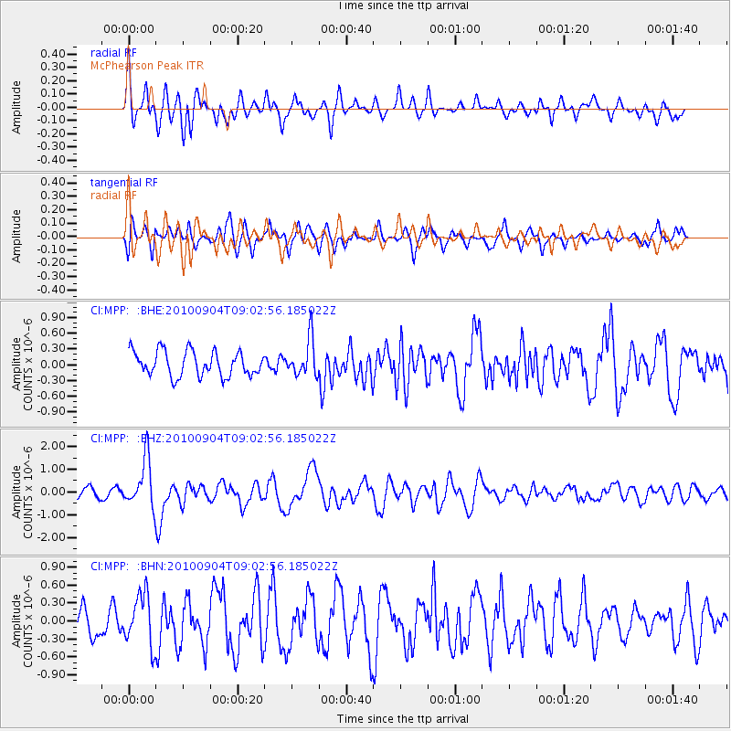
MPP McPhearson Peak - Earthquake Result Viewer
*The percent match for this event was below the threshold and hence no stack was calculated.
| Earthquake location: |
Tonga Islands |
| Earthquake latitude/longitude: |
-17.4/-174.0 |
| Earthquake time(UTC): |
2010/09/04 (247) 08:52:04 GMT |
| Earthquake Depth: |
69 km |
| Earthquake Magnitude: |
5.9 MB, 6.1 MW, 6.0 MW |
| Earthquake Catalog/Contributor: |
WHDF/NEIC |
|
| Network: |
CI Caltech Regional Seismic Network |
| Station: |
MPP McPhearson Peak |
| Lat/Lon: |
34.89 N/119.81 W |
| Elevation: |
1739 m |
|
| Distance: |
73.1 deg |
| Az: |
44.159 deg |
| Baz: |
234.027 deg |
| Ray Param: |
$rayparam |
*The percent match for this event was below the threshold and hence was not used in the summary stack. |
|
| Radial Match: |
75.30032 % |
| Radial Bump: |
400 |
| Transverse Match: |
70.66077 % |
| Transverse Bump: |
400 |
| SOD ConfigId: |
319893 |
| Insert Time: |
2011-01-13 07:54:58.528 +0000 |
| GWidth: |
2.5 |
| Max Bumps: |
400 |
| Tol: |
0.001 |
|
Signal To Noise
| Channel | StoN | STA | LTA |
| CI:MPP: :BHZ:20100904T09:02:56.185022Z | 3.4758186 | 1.0602758E-6 | 3.0504347E-7 |
| CI:MPP: :BHN:20100904T09:02:56.185022Z | 1.5079732 | 4.2968415E-7 | 2.849415E-7 |
| CI:MPP: :BHE:20100904T09:02:56.185022Z | 1.5275294 | 3.6148555E-7 | 2.366472E-7 |
| Arrivals |
| Ps | |
| PpPs | |
| PsPs/PpSs | |


