You are here: Home > Network List > US - United States National Seismic Network Stations List
> Station AGMN Agassiz National Wildlife Refuge, Minnesota, USA > Earthquake Result Viewer
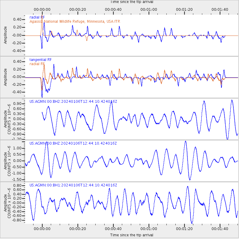
AGMN Agassiz National Wildlife Refuge, Minnesota, USA - Earthquake Result Viewer
*The percent match for this event was below the threshold and hence no stack was calculated.
| Earthquake location: |
Southern East Pacific Rise |
| Earthquake latitude/longitude: |
-24.4/-116.0 |
| Earthquake time(UTC): |
2024/01/06 (006) 12:33:02 GMT |
| Earthquake Depth: |
10 km |
| Earthquake Magnitude: |
5.5 Mwb |
| Earthquake Catalog/Contributor: |
NEIC PDE/us |
|
| Network: |
US United States National Seismic Network |
| Station: |
AGMN Agassiz National Wildlife Refuge, Minnesota, USA |
| Lat/Lon: |
48.30 N/95.86 W |
| Elevation: |
351 m |
|
| Distance: |
74.6 deg |
| Az: |
13.774 deg |
| Baz: |
198.968 deg |
| Ray Param: |
$rayparam |
*The percent match for this event was below the threshold and hence was not used in the summary stack. |
|
| Radial Match: |
58.270386 % |
| Radial Bump: |
400 |
| Transverse Match: |
72.913895 % |
| Transverse Bump: |
400 |
| SOD ConfigId: |
33437571 |
| Insert Time: |
2024-01-26 12:09:36.212 +0000 |
| GWidth: |
2.5 |
| Max Bumps: |
400 |
| Tol: |
0.001 |
|
Signal To Noise
| Channel | StoN | STA | LTA |
| US:AGMN:00:BHZ:20240106T12:44:10.424016Z | 1.9764514 | 9.606074E-7 | 4.860263E-7 |
| US:AGMN:00:BH1:20240106T12:44:10.424016Z | 0.9718155 | 2.8371636E-7 | 2.9194467E-7 |
| US:AGMN:00:BH2:20240106T12:44:10.424016Z | 1.2588699 | 5.03607E-7 | 4.000469E-7 |
| Arrivals |
| Ps | |
| PpPs | |
| PsPs/PpSs | |


