You are here: Home > Network List > G - GEOSCOPE Stations List
> Station UNM Unam,Mexico > Earthquake Result Viewer
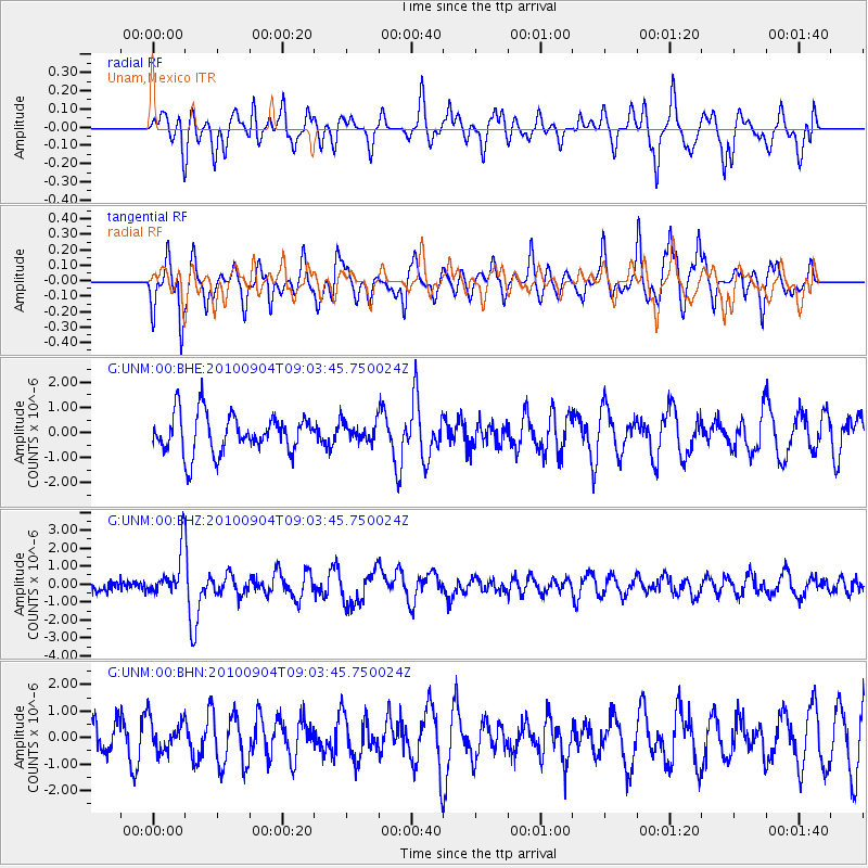
UNM Unam,Mexico - Earthquake Result Viewer
*The percent match for this event was below the threshold and hence no stack was calculated.
| Earthquake location: |
Tonga Islands |
| Earthquake latitude/longitude: |
-17.4/-174.0 |
| Earthquake time(UTC): |
2010/09/04 (247) 08:52:04 GMT |
| Earthquake Depth: |
69 km |
| Earthquake Magnitude: |
5.9 MB, 6.1 MW, 6.0 MW |
| Earthquake Catalog/Contributor: |
WHDF/NEIC |
|
| Network: |
G GEOSCOPE |
| Station: |
UNM Unam,Mexico |
| Lat/Lon: |
19.33 N/99.18 W |
| Elevation: |
2280 m |
|
| Distance: |
82.0 deg |
| Az: |
66.963 deg |
| Baz: |
248.533 deg |
| Ray Param: |
$rayparam |
*The percent match for this event was below the threshold and hence was not used in the summary stack. |
|
| Radial Match: |
56.956314 % |
| Radial Bump: |
400 |
| Transverse Match: |
72.97068 % |
| Transverse Bump: |
400 |
| SOD ConfigId: |
319893 |
| Insert Time: |
2011-01-13 07:56:26.213 +0000 |
| GWidth: |
2.5 |
| Max Bumps: |
400 |
| Tol: |
0.001 |
|
Signal To Noise
| Channel | StoN | STA | LTA |
| G:UNM:00:BHZ:20100904T09:03:45.750024Z | 3.6681423 | 1.3180189E-6 | 3.5931512E-7 |
| G:UNM:00:BHN:20100904T09:03:45.750024Z | 1.0008557 | 6.145826E-7 | 6.140571E-7 |
| G:UNM:00:BHE:20100904T09:03:45.750024Z | 0.5008501 | 3.907367E-7 | 7.80147E-7 |
| Arrivals |
| Ps | |
| PpPs | |
| PsPs/PpSs | |


