You are here: Home > Network List > TA - USArray Transportable Network (new EarthScope stations) Stations List
> Station N23A Red Feather Lakes, CO, USA > Earthquake Result Viewer
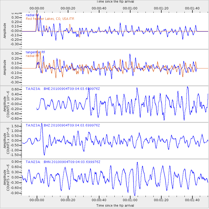
N23A Red Feather Lakes, CO, USA - Earthquake Result Viewer
*The percent match for this event was below the threshold and hence no stack was calculated.
| Earthquake location: |
Tonga Islands |
| Earthquake latitude/longitude: |
-17.4/-174.0 |
| Earthquake time(UTC): |
2010/09/04 (247) 08:52:04 GMT |
| Earthquake Depth: |
69 km |
| Earthquake Magnitude: |
5.9 MB, 6.1 MW, 6.0 MW |
| Earthquake Catalog/Contributor: |
WHDF/NEIC |
|
| Network: |
TA USArray Transportable Network (new EarthScope stations) |
| Station: |
N23A Red Feather Lakes, CO, USA |
| Lat/Lon: |
40.89 N/105.94 W |
| Elevation: |
2458 m |
|
| Distance: |
85.6 deg |
| Az: |
44.85 deg |
| Baz: |
242.676 deg |
| Ray Param: |
$rayparam |
*The percent match for this event was below the threshold and hence was not used in the summary stack. |
|
| Radial Match: |
67.25294 % |
| Radial Bump: |
400 |
| Transverse Match: |
64.01686 % |
| Transverse Bump: |
371 |
| SOD ConfigId: |
319893 |
| Insert Time: |
2011-01-13 08:01:03.322 +0000 |
| GWidth: |
2.5 |
| Max Bumps: |
400 |
| Tol: |
0.001 |
|
Signal To Noise
| Channel | StoN | STA | LTA |
| TA:N23A: :BHZ:20100904T09:04:03.699976Z | 3.861439 | 8.393337E-7 | 2.1736294E-7 |
| TA:N23A: :BHN:20100904T09:04:03.699976Z | 1.0236063 | 1.9701093E-7 | 1.9246748E-7 |
| TA:N23A: :BHE:20100904T09:04:03.699976Z | 1.9216988 | 3.0688685E-7 | 1.596956E-7 |
| Arrivals |
| Ps | |
| PpPs | |
| PsPs/PpSs | |


