You are here: Home > Network List > G - GEOSCOPE Stations List
> Station INU Inuyama, Japan > Earthquake Result Viewer
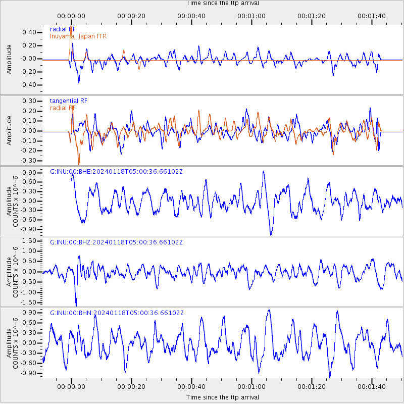
INU Inuyama, Japan - Earthquake Result Viewer
*The percent match for this event was below the threshold and hence no stack was calculated.
| Earthquake location: |
Fiji Islands Region |
| Earthquake latitude/longitude: |
-21.7/-176.3 |
| Earthquake time(UTC): |
2024/01/18 (018) 04:50:01 GMT |
| Earthquake Depth: |
155 km |
| Earthquake Magnitude: |
5.8 mww |
| Earthquake Catalog/Contributor: |
NEIC PDE/us |
|
| Network: |
G GEOSCOPE |
| Station: |
INU Inuyama, Japan |
| Lat/Lon: |
35.35 N/137.03 E |
| Elevation: |
132 m |
|
| Distance: |
71.9 deg |
| Az: |
321.246 deg |
| Baz: |
134.571 deg |
| Ray Param: |
$rayparam |
*The percent match for this event was below the threshold and hence was not used in the summary stack. |
|
| Radial Match: |
37.147133 % |
| Radial Bump: |
390 |
| Transverse Match: |
49.05448 % |
| Transverse Bump: |
400 |
| SOD ConfigId: |
33437571 |
| Insert Time: |
2024-02-01 05:02:21.414 +0000 |
| GWidth: |
2.5 |
| Max Bumps: |
400 |
| Tol: |
0.001 |
|
Signal To Noise
| Channel | StoN | STA | LTA |
| G:INU:00:BHZ:20240118T05:00:36.66102Z | 2.2369645 | 5.7074345E-7 | 2.551419E-7 |
| G:INU:00:BHN:20240118T05:00:36.66102Z | 0.8766189 | 2.6000964E-7 | 2.9660507E-7 |
| G:INU:00:BHE:20240118T05:00:36.66102Z | 0.701921 | 2.498659E-7 | 3.559744E-7 |
| Arrivals |
| Ps | |
| PpPs | |
| PsPs/PpSs | |


