You are here: Home > Network List > AV - Alaska Volcano Observatory Stations List
> Station PLBL Mt. Peulik Volcano, Alaska > Earthquake Result Viewer
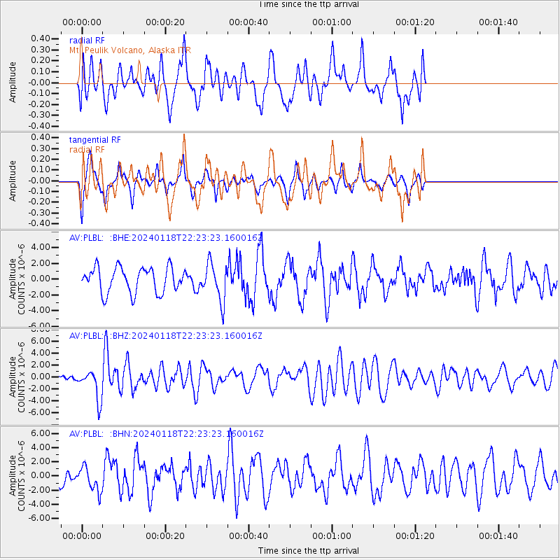
PLBL Mt. Peulik Volcano, Alaska - Earthquake Result Viewer
*The percent match for this event was below the threshold and hence no stack was calculated.
| Earthquake location: |
Tonga Islands |
| Earthquake latitude/longitude: |
-18.9/-175.1 |
| Earthquake time(UTC): |
2024/01/18 (018) 22:12:20 GMT |
| Earthquake Depth: |
218 km |
| Earthquake Magnitude: |
6.4 Mww |
| Earthquake Catalog/Contributor: |
NEIC PDE/us |
|
| Network: |
AV Alaska Volcano Observatory |
| Station: |
PLBL Mt. Peulik Volcano, Alaska |
| Lat/Lon: |
57.70 N/156.82 W |
| Elevation: |
461 m |
|
| Distance: |
77.9 deg |
| Az: |
9.944 deg |
| Baz: |
197.725 deg |
| Ray Param: |
$rayparam |
*The percent match for this event was below the threshold and hence was not used in the summary stack. |
|
| Radial Match: |
49.365765 % |
| Radial Bump: |
400 |
| Transverse Match: |
52.919594 % |
| Transverse Bump: |
286 |
| SOD ConfigId: |
33437571 |
| Insert Time: |
2024-02-01 22:20:52.532 +0000 |
| GWidth: |
2.5 |
| Max Bumps: |
400 |
| Tol: |
0.001 |
|
Signal To Noise
| Channel | StoN | STA | LTA |
| AV:PLBL: :BHZ:20240118T22:23:23.160016Z | 2.8820221 | 2.585834E-6 | 8.9722903E-7 |
| AV:PLBL: :BHN:20240118T22:23:23.160016Z | 1.2388098 | 1.7928705E-6 | 1.4472524E-6 |
| AV:PLBL: :BHE:20240118T22:23:23.160016Z | 1.5390315 | 2.4458743E-6 | 1.5892296E-6 |
| Arrivals |
| Ps | |
| PpPs | |
| PsPs/PpSs | |


