You are here: Home > Network List > CN - Canadian National Seismograph Network Stations List
> Station INK INUVIK, NT > Earthquake Result Viewer
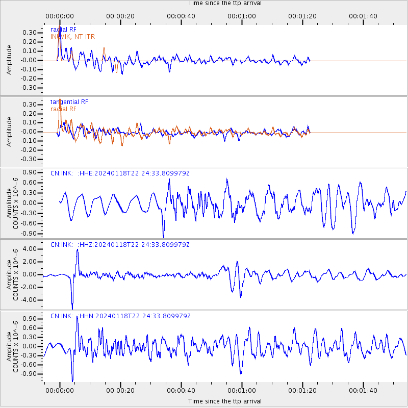
INK INUVIK, NT - Earthquake Result Viewer
*The percent match for this event was below the threshold and hence no stack was calculated.
| Earthquake location: |
Tonga Islands |
| Earthquake latitude/longitude: |
-18.9/-175.1 |
| Earthquake time(UTC): |
2024/01/18 (018) 22:12:20 GMT |
| Earthquake Depth: |
218 km |
| Earthquake Magnitude: |
6.4 Mww |
| Earthquake Catalog/Contributor: |
NEIC PDE/us |
|
| Network: |
CN Canadian National Seismograph Network |
| Station: |
INK INUVIK, NT |
| Lat/Lon: |
68.31 N/133.53 W |
| Elevation: |
44 m |
|
| Distance: |
92.1 deg |
| Az: |
14.306 deg |
| Baz: |
218.987 deg |
| Ray Param: |
$rayparam |
*The percent match for this event was below the threshold and hence was not used in the summary stack. |
|
| Radial Match: |
69.049065 % |
| Radial Bump: |
400 |
| Transverse Match: |
61.15483 % |
| Transverse Bump: |
400 |
| SOD ConfigId: |
33437571 |
| Insert Time: |
2024-02-01 22:25:12.668 +0000 |
| GWidth: |
2.5 |
| Max Bumps: |
400 |
| Tol: |
0.001 |
|
Signal To Noise
| Channel | StoN | STA | LTA |
| CN:INK: :HHZ:20240118T22:24:33.809979Z | 5.7073946 | 1.4746151E-6 | 2.5836923E-7 |
| CN:INK: :HHN:20240118T22:24:33.809979Z | 1.9033223 | 3.393614E-7 | 1.7829949E-7 |
| CN:INK: :HHE:20240118T22:24:33.809979Z | 1.6331186 | 3.4398607E-7 | 2.106314E-7 |
| Arrivals |
| Ps | |
| PpPs | |
| PsPs/PpSs | |


