You are here: Home > Network List > TA - USArray Transportable Network (new EarthScope stations) Stations List
> Station H27A Howes, SD, USA > Earthquake Result Viewer
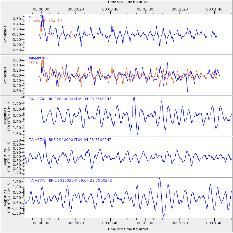
H27A Howes, SD, USA - Earthquake Result Viewer
*The percent match for this event was below the threshold and hence no stack was calculated.
| Earthquake location: |
Tonga Islands |
| Earthquake latitude/longitude: |
-17.4/-174.0 |
| Earthquake time(UTC): |
2010/09/04 (247) 08:52:04 GMT |
| Earthquake Depth: |
69 km |
| Earthquake Magnitude: |
5.9 MB, 6.1 MW, 6.0 MW |
| Earthquake Catalog/Contributor: |
WHDF/NEIC |
|
| Network: |
TA USArray Transportable Network (new EarthScope stations) |
| Station: |
H27A Howes, SD, USA |
| Lat/Lon: |
44.63 N/102.08 W |
| Elevation: |
748 m |
|
| Distance: |
89.8 deg |
| Az: |
42.745 deg |
| Baz: |
245.208 deg |
| Ray Param: |
$rayparam |
*The percent match for this event was below the threshold and hence was not used in the summary stack. |
|
| Radial Match: |
59.97435 % |
| Radial Bump: |
325 |
| Transverse Match: |
51.20289 % |
| Transverse Bump: |
363 |
| SOD ConfigId: |
319893 |
| Insert Time: |
2011-01-13 08:10:14.838 +0000 |
| GWidth: |
2.5 |
| Max Bumps: |
400 |
| Tol: |
0.001 |
|
Signal To Noise
| Channel | StoN | STA | LTA |
| TA:H27A: :BHZ:20100904T09:04:23.750024Z | 2.0061426 | 5.434085E-7 | 2.708723E-7 |
| TA:H27A: :BHN:20100904T09:04:23.750024Z | 1.2562404 | 5.117545E-7 | 4.0736987E-7 |
| TA:H27A: :BHE:20100904T09:04:23.750024Z | 0.9759388 | 4.2380753E-7 | 4.3425624E-7 |
| Arrivals |
| Ps | |
| PpPs | |
| PsPs/PpSs | |


