You are here: Home > Network List > UW - Pacific Northwest Regional Seismic Network Stations List
> Station IRON Crane, OR, USA > Earthquake Result Viewer
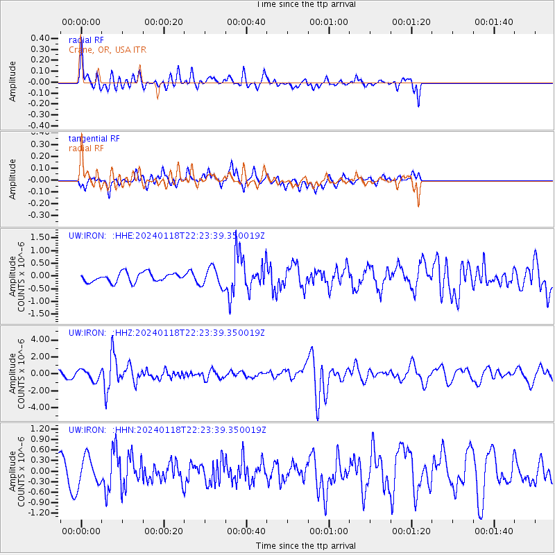
IRON Crane, OR, USA - Earthquake Result Viewer
*The percent match for this event was below the threshold and hence no stack was calculated.
| Earthquake location: |
Tonga Islands |
| Earthquake latitude/longitude: |
-18.9/-175.1 |
| Earthquake time(UTC): |
2024/01/18 (018) 22:12:20 GMT |
| Earthquake Depth: |
218 km |
| Earthquake Magnitude: |
6.4 Mww |
| Earthquake Catalog/Contributor: |
NEIC PDE/us |
|
| Network: |
UW Pacific Northwest Regional Seismic Network |
| Station: |
IRON Crane, OR, USA |
| Lat/Lon: |
43.36 N/118.47 W |
| Elevation: |
1226 m |
|
| Distance: |
80.9 deg |
| Az: |
38.116 deg |
| Baz: |
233.233 deg |
| Ray Param: |
$rayparam |
*The percent match for this event was below the threshold and hence was not used in the summary stack. |
|
| Radial Match: |
70.489876 % |
| Radial Bump: |
400 |
| Transverse Match: |
62.09295 % |
| Transverse Bump: |
400 |
| SOD ConfigId: |
33437571 |
| Insert Time: |
2024-02-01 22:36:59.684 +0000 |
| GWidth: |
2.5 |
| Max Bumps: |
400 |
| Tol: |
0.001 |
|
Signal To Noise
| Channel | StoN | STA | LTA |
| UW:IRON: :HHZ:20240118T22:23:39.350019Z | 1.9446235 | 6.334219E-7 | 3.2572984E-7 |
| UW:IRON: :HHN:20240118T22:23:39.350019Z | 0.7353316 | 3.9441855E-7 | 5.363819E-7 |
| UW:IRON: :HHE:20240118T22:23:39.350019Z | 2.073864 | 3.785241E-7 | 1.8252118E-7 |
| Arrivals |
| Ps | |
| PpPs | |
| PsPs/PpSs | |


