You are here: Home > Network List > TA - USArray Transportable Network (new EarthScope stations) Stations List
> Station F29A Eureka, SD, USA > Earthquake Result Viewer
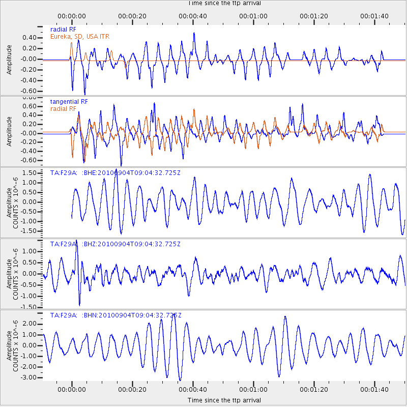
F29A Eureka, SD, USA - Earthquake Result Viewer
*The percent match for this event was below the threshold and hence no stack was calculated.
| Earthquake location: |
Tonga Islands |
| Earthquake latitude/longitude: |
-17.4/-174.0 |
| Earthquake time(UTC): |
2010/09/04 (247) 08:52:04 GMT |
| Earthquake Depth: |
69 km |
| Earthquake Magnitude: |
5.9 MB, 6.1 MW, 6.0 MW |
| Earthquake Catalog/Contributor: |
WHDF/NEIC |
|
| Network: |
TA USArray Transportable Network (new EarthScope stations) |
| Station: |
F29A Eureka, SD, USA |
| Lat/Lon: |
45.83 N/99.83 W |
| Elevation: |
575 m |
|
| Distance: |
91.7 deg |
| Az: |
42.295 deg |
| Baz: |
246.806 deg |
| Ray Param: |
$rayparam |
*The percent match for this event was below the threshold and hence was not used in the summary stack. |
|
| Radial Match: |
59.65625 % |
| Radial Bump: |
327 |
| Transverse Match: |
54.483673 % |
| Transverse Bump: |
289 |
| SOD ConfigId: |
319893 |
| Insert Time: |
2011-01-13 08:12:56.863 +0000 |
| GWidth: |
2.5 |
| Max Bumps: |
400 |
| Tol: |
0.001 |
|
Signal To Noise
| Channel | StoN | STA | LTA |
| TA:F29A: :BHZ:20100904T09:04:32.725Z | 2.3516538 | 6.539718E-7 | 2.7809017E-7 |
| TA:F29A: :BHN:20100904T09:04:32.725Z | 0.6806719 | 5.2792643E-7 | 7.755961E-7 |
| TA:F29A: :BHE:20100904T09:04:32.725Z | 0.8161256 | 6.616375E-7 | 8.1070544E-7 |
| Arrivals |
| Ps | |
| PpPs | |
| PsPs/PpSs | |


