You are here: Home > Network List > US - United States National Seismic Network Stations List
> Station WUAZ Wupatki, Arizona, USA > Earthquake Result Viewer
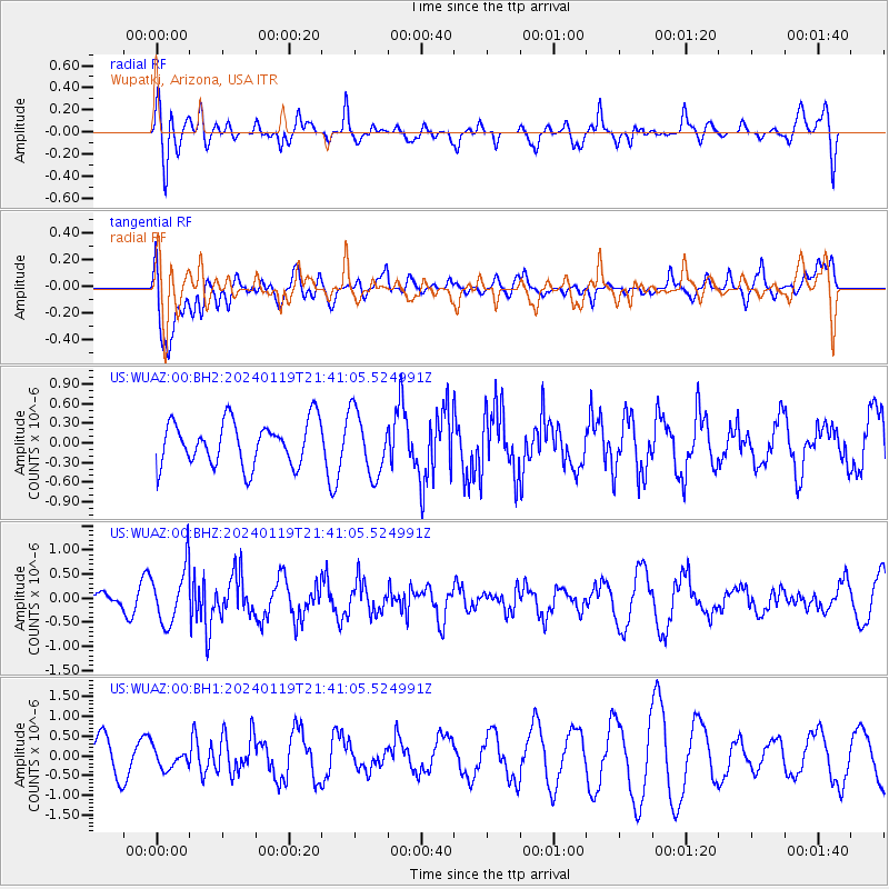
WUAZ Wupatki, Arizona, USA - Earthquake Result Viewer
*The percent match for this event was below the threshold and hence no stack was calculated.
| Earthquake location: |
Central Alaska |
| Earthquake latitude/longitude: |
64.5/-147.0 |
| Earthquake time(UTC): |
2024/01/19 (019) 21:34:34 GMT |
| Earthquake Depth: |
10 km |
| Earthquake Magnitude: |
5.3 ml |
| Earthquake Catalog/Contributor: |
NEIC PDE/ak |
|
| Network: |
US United States National Seismic Network |
| Station: |
WUAZ Wupatki, Arizona, USA |
| Lat/Lon: |
35.52 N/111.37 W |
| Elevation: |
1592 m |
|
| Distance: |
36.1 deg |
| Az: |
126.213 deg |
| Baz: |
334.661 deg |
| Ray Param: |
$rayparam |
*The percent match for this event was below the threshold and hence was not used in the summary stack. |
|
| Radial Match: |
53.944866 % |
| Radial Bump: |
400 |
| Transverse Match: |
43.826324 % |
| Transverse Bump: |
400 |
| SOD ConfigId: |
33437571 |
| Insert Time: |
2024-02-02 21:54:16.415 +0000 |
| GWidth: |
2.5 |
| Max Bumps: |
400 |
| Tol: |
0.001 |
|
Signal To Noise
| Channel | StoN | STA | LTA |
| US:WUAZ:00:BHZ:20240119T21:41:05.524991Z | 3.2661302 | 5.7963206E-7 | 1.7746753E-7 |
| US:WUAZ:00:BH1:20240119T21:41:05.524991Z | 0.72739017 | 2.6068912E-7 | 3.5838966E-7 |
| US:WUAZ:00:BH2:20240119T21:41:05.524991Z | 1.4434667 | 4.8206954E-7 | 3.339665E-7 |
| Arrivals |
| Ps | |
| PpPs | |
| PsPs/PpSs | |


