You are here: Home > Network List > TA - USArray Transportable Network (new EarthScope stations) Stations List
> Station 436A Wall Ranch, Gause, TX, USA > Earthquake Result Viewer
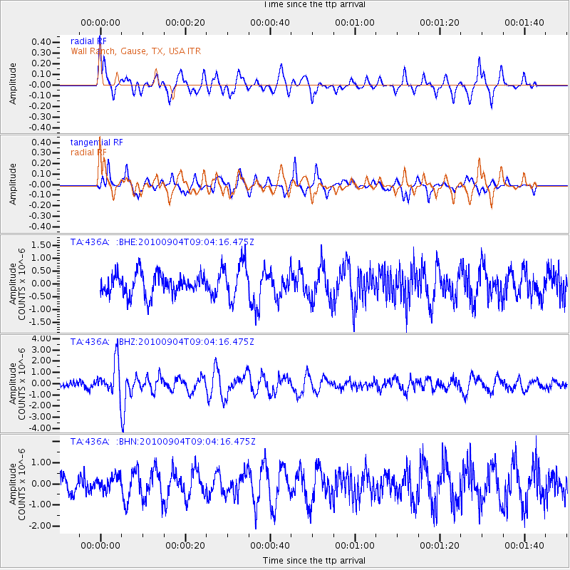
436A Wall Ranch, Gause, TX, USA - Earthquake Result Viewer
*The percent match for this event was below the threshold and hence no stack was calculated.
| Earthquake location: |
Tonga Islands |
| Earthquake latitude/longitude: |
-17.4/-174.0 |
| Earthquake time(UTC): |
2010/09/04 (247) 08:52:04 GMT |
| Earthquake Depth: |
69 km |
| Earthquake Magnitude: |
5.9 MB, 6.1 MW, 6.0 MW |
| Earthquake Catalog/Contributor: |
WHDF/NEIC |
|
| Network: |
TA USArray Transportable Network (new EarthScope stations) |
| Station: |
436A Wall Ranch, Gause, TX, USA |
| Lat/Lon: |
30.77 N/96.80 W |
| Elevation: |
109 m |
|
| Distance: |
88.2 deg |
| Az: |
57.114 deg |
| Baz: |
248.702 deg |
| Ray Param: |
$rayparam |
*The percent match for this event was below the threshold and hence was not used in the summary stack. |
|
| Radial Match: |
63.505653 % |
| Radial Bump: |
400 |
| Transverse Match: |
57.418015 % |
| Transverse Bump: |
268 |
| SOD ConfigId: |
319893 |
| Insert Time: |
2011-01-13 08:19:05.388 +0000 |
| GWidth: |
2.5 |
| Max Bumps: |
400 |
| Tol: |
0.001 |
|
Signal To Noise
| Channel | StoN | STA | LTA |
| TA:436A: :BHZ:20100904T09:04:16.475Z | 4.875165 | 1.5372746E-6 | 3.1532767E-7 |
| TA:436A: :BHN:20100904T09:04:16.475Z | 0.7822326 | 3.5925567E-7 | 4.5926964E-7 |
| TA:436A: :BHE:20100904T09:04:16.475Z | 1.8181599 | 7.3693604E-7 | 4.053197E-7 |
| Arrivals |
| Ps | |
| PpPs | |
| PsPs/PpSs | |


