You are here: Home > Network List > TA - USArray Transportable Network (new EarthScope stations) Stations List
> Station Z36A Blue Ridge, TX, USA > Earthquake Result Viewer
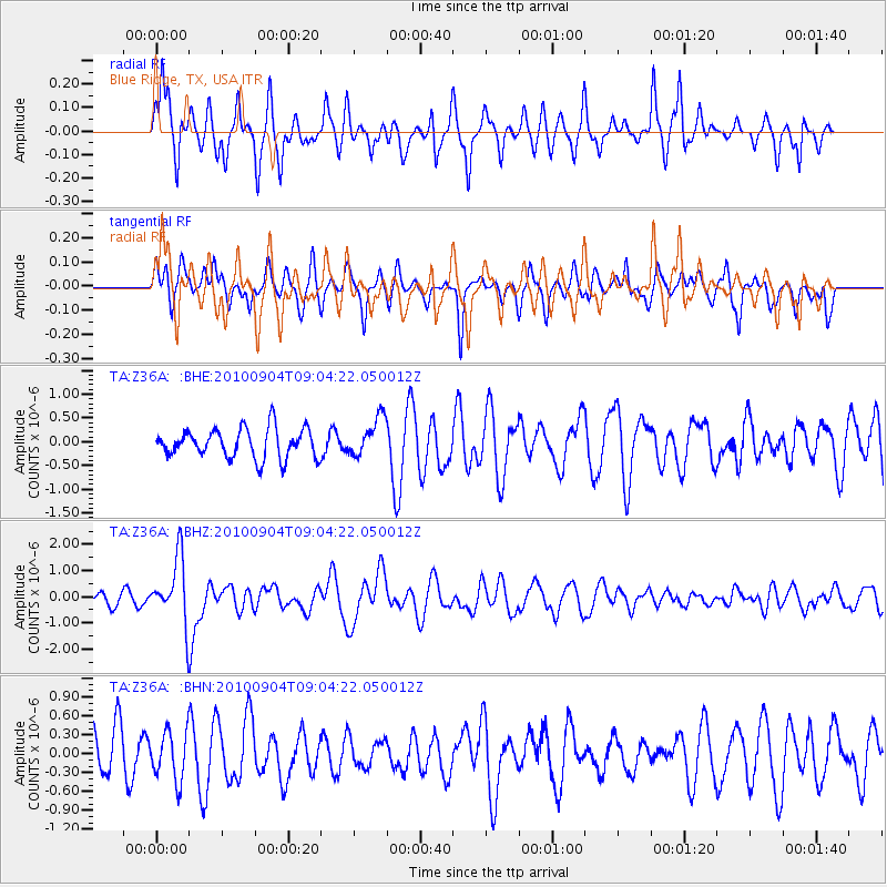
Z36A Blue Ridge, TX, USA - Earthquake Result Viewer
*The percent match for this event was below the threshold and hence no stack was calculated.
| Earthquake location: |
Tonga Islands |
| Earthquake latitude/longitude: |
-17.4/-174.0 |
| Earthquake time(UTC): |
2010/09/04 (247) 08:52:04 GMT |
| Earthquake Depth: |
69 km |
| Earthquake Magnitude: |
5.9 MB, 6.1 MW, 6.0 MW |
| Earthquake Catalog/Contributor: |
WHDF/NEIC |
|
| Network: |
TA USArray Transportable Network (new EarthScope stations) |
| Station: |
Z36A Blue Ridge, TX, USA |
| Lat/Lon: |
33.27 N/96.43 W |
| Elevation: |
187 m |
|
| Distance: |
89.4 deg |
| Az: |
54.902 deg |
| Baz: |
248.847 deg |
| Ray Param: |
$rayparam |
*The percent match for this event was below the threshold and hence was not used in the summary stack. |
|
| Radial Match: |
65.527596 % |
| Radial Bump: |
346 |
| Transverse Match: |
44.4644 % |
| Transverse Bump: |
336 |
| SOD ConfigId: |
319893 |
| Insert Time: |
2011-01-13 08:23:02.773 +0000 |
| GWidth: |
2.5 |
| Max Bumps: |
400 |
| Tol: |
0.001 |
|
Signal To Noise
| Channel | StoN | STA | LTA |
| TA:Z36A: :BHZ:20100904T09:04:22.050012Z | 6.03805 | 1.2371772E-6 | 2.048968E-7 |
| TA:Z36A: :BHN:20100904T09:04:22.050012Z | 0.8402379 | 3.884939E-7 | 4.6236178E-7 |
| TA:Z36A: :BHE:20100904T09:04:22.050012Z | 1.3104284 | 4.065144E-7 | 3.1021492E-7 |
| Arrivals |
| Ps | |
| PpPs | |
| PsPs/PpSs | |


