You are here: Home > Network List > TA - USArray Transportable Network (new EarthScope stations) Stations List
> Station L32A Elgin, NE, USA > Earthquake Result Viewer
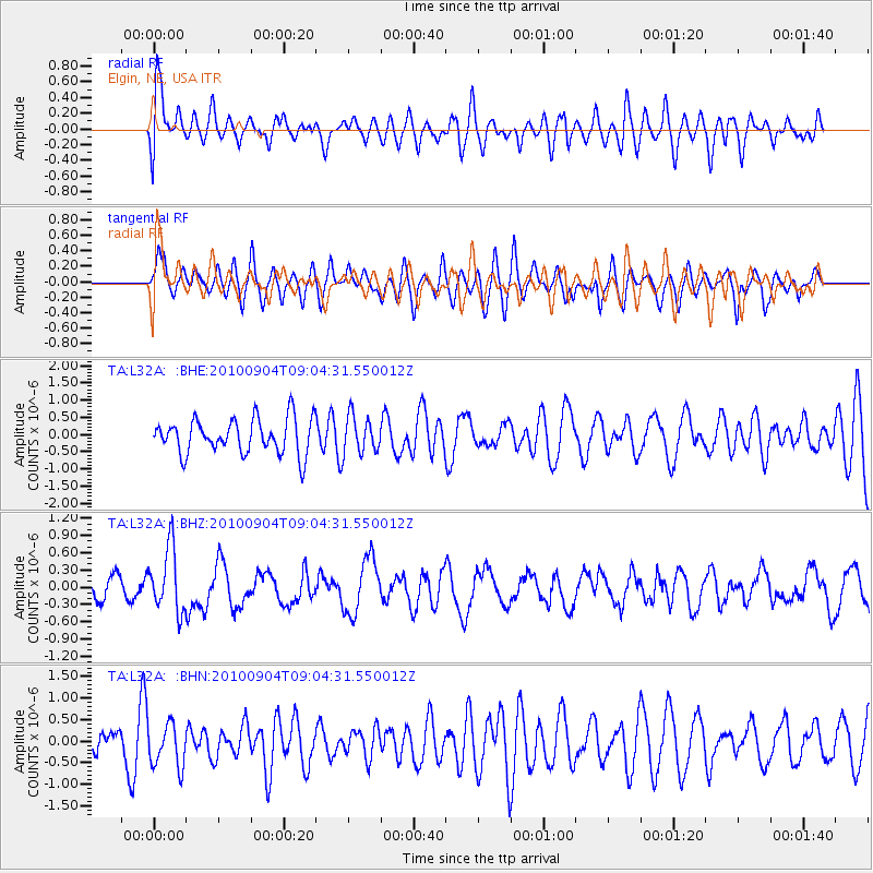
L32A Elgin, NE, USA - Earthquake Result Viewer
*The percent match for this event was below the threshold and hence no stack was calculated.
| Earthquake location: |
Tonga Islands |
| Earthquake latitude/longitude: |
-17.4/-174.0 |
| Earthquake time(UTC): |
2010/09/04 (247) 08:52:04 GMT |
| Earthquake Depth: |
69 km |
| Earthquake Magnitude: |
5.9 MB, 6.1 MW, 6.0 MW |
| Earthquake Catalog/Contributor: |
WHDF/NEIC |
|
| Network: |
TA USArray Transportable Network (new EarthScope stations) |
| Station: |
L32A Elgin, NE, USA |
| Lat/Lon: |
42.00 N/98.01 W |
| Elevation: |
586 m |
|
| Distance: |
91.5 deg |
| Az: |
46.335 deg |
| Baz: |
247.953 deg |
| Ray Param: |
$rayparam |
*The percent match for this event was below the threshold and hence was not used in the summary stack. |
|
| Radial Match: |
61.080067 % |
| Radial Bump: |
400 |
| Transverse Match: |
51.532146 % |
| Transverse Bump: |
400 |
| SOD ConfigId: |
319893 |
| Insert Time: |
2011-01-13 08:24:03.787 +0000 |
| GWidth: |
2.5 |
| Max Bumps: |
400 |
| Tol: |
0.001 |
|
Signal To Noise
| Channel | StoN | STA | LTA |
| TA:L32A: :BHZ:20100904T09:04:31.550012Z | 3.1432343 | 5.5909993E-7 | 1.7787409E-7 |
| TA:L32A: :BHN:20100904T09:04:31.550012Z | 1.7993863 | 4.993573E-7 | 2.7751537E-7 |
| TA:L32A: :BHE:20100904T09:04:31.550012Z | 1.046561 | 5.2823833E-7 | 5.047373E-7 |
| Arrivals |
| Ps | |
| PpPs | |
| PsPs/PpSs | |


