You are here: Home > Network List > TA - USArray Transportable Network (new EarthScope stations) Stations List
> Station J34A George, IA, USA > Earthquake Result Viewer
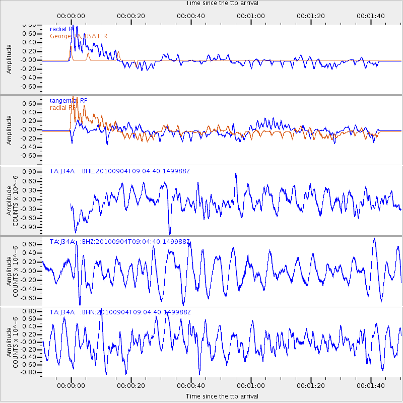
J34A George, IA, USA - Earthquake Result Viewer
*The percent match for this event was below the threshold and hence no stack was calculated.
| Earthquake location: |
Tonga Islands |
| Earthquake latitude/longitude: |
-17.4/-174.0 |
| Earthquake time(UTC): |
2010/09/04 (247) 08:52:04 GMT |
| Earthquake Depth: |
69 km |
| Earthquake Magnitude: |
5.9 MB, 6.1 MW, 6.0 MW |
| Earthquake Catalog/Contributor: |
WHDF/NEIC |
|
| Network: |
TA USArray Transportable Network (new EarthScope stations) |
| Station: |
J34A George, IA, USA |
| Lat/Lon: |
43.28 N/95.96 W |
| Elevation: |
432 m |
|
| Distance: |
93.3 deg |
| Az: |
45.694 deg |
| Baz: |
249.363 deg |
| Ray Param: |
$rayparam |
*The percent match for this event was below the threshold and hence was not used in the summary stack. |
|
| Radial Match: |
64.99531 % |
| Radial Bump: |
400 |
| Transverse Match: |
48.952576 % |
| Transverse Bump: |
400 |
| SOD ConfigId: |
319893 |
| Insert Time: |
2011-01-13 08:24:41.421 +0000 |
| GWidth: |
2.5 |
| Max Bumps: |
400 |
| Tol: |
0.001 |
|
Signal To Noise
| Channel | StoN | STA | LTA |
| TA:J34A: :BHZ:20100904T09:04:40.149988Z | 1.2416356 | 3.4578085E-7 | 2.784882E-7 |
| TA:J34A: :BHN:20100904T09:04:40.149988Z | 1.2050596 | 3.6960398E-7 | 3.067101E-7 |
| TA:J34A: :BHE:20100904T09:04:40.149988Z | 1.3807967 | 5.186984E-7 | 3.7565158E-7 |
| Arrivals |
| Ps | |
| PpPs | |
| PsPs/PpSs | |


