You are here: Home > Network List > TA - USArray Transportable Network (new EarthScope stations) Stations List
> Station K31A O'Neill, NE, USA > Earthquake Result Viewer
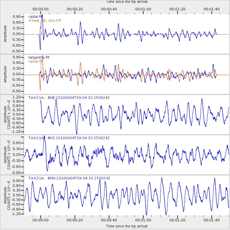
K31A O'Neill, NE, USA - Earthquake Result Viewer
*The percent match for this event was below the threshold and hence no stack was calculated.
| Earthquake location: |
Tonga Islands |
| Earthquake latitude/longitude: |
-17.4/-174.0 |
| Earthquake time(UTC): |
2010/09/04 (247) 08:52:04 GMT |
| Earthquake Depth: |
69 km |
| Earthquake Magnitude: |
5.9 MB, 6.1 MW, 6.0 MW |
| Earthquake Catalog/Contributor: |
WHDF/NEIC |
|
| Network: |
TA USArray Transportable Network (new EarthScope stations) |
| Station: |
K31A O'Neill, NE, USA |
| Lat/Lon: |
42.62 N/98.75 W |
| Elevation: |
580 m |
|
| Distance: |
91.2 deg |
| Az: |
45.553 deg |
| Baz: |
247.47 deg |
| Ray Param: |
$rayparam |
*The percent match for this event was below the threshold and hence was not used in the summary stack. |
|
| Radial Match: |
67.49424 % |
| Radial Bump: |
400 |
| Transverse Match: |
49.165913 % |
| Transverse Bump: |
400 |
| SOD ConfigId: |
319893 |
| Insert Time: |
2011-01-13 08:26:16.599 +0000 |
| GWidth: |
2.5 |
| Max Bumps: |
400 |
| Tol: |
0.001 |
|
Signal To Noise
| Channel | StoN | STA | LTA |
| TA:K31A: :BHZ:20100904T09:04:30.250024Z | 2.3865569 | 4.907594E-7 | 2.0563492E-7 |
| TA:K31A: :BHN:20100904T09:04:30.250024Z | 0.83641624 | 3.7077794E-7 | 4.4329357E-7 |
| TA:K31A: :BHE:20100904T09:04:30.250024Z | 1.0445912 | 5.009487E-7 | 4.795644E-7 |
| Arrivals |
| Ps | |
| PpPs | |
| PsPs/PpSs | |


