You are here: Home > Network List > US - United States National Seismic Network Stations List
> Station EGMT Eagleton, Montana, USA > Earthquake Result Viewer
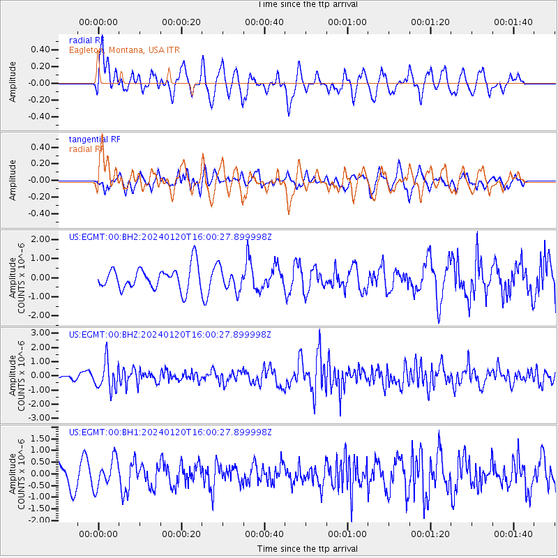
EGMT Eagleton, Montana, USA - Earthquake Result Viewer
*The percent match for this event was below the threshold and hence no stack was calculated.
| Earthquake location: |
Mariana Islands |
| Earthquake latitude/longitude: |
18.5/145.6 |
| Earthquake time(UTC): |
2024/01/20 (020) 15:48:41 GMT |
| Earthquake Depth: |
195 km |
| Earthquake Magnitude: |
6.1 mww |
| Earthquake Catalog/Contributor: |
NEIC PDE/us |
|
| Network: |
US United States National Seismic Network |
| Station: |
EGMT Eagleton, Montana, USA |
| Lat/Lon: |
48.02 N/109.75 W |
| Elevation: |
1055 m |
|
| Distance: |
85.9 deg |
| Az: |
40.624 deg |
| Baz: |
292.996 deg |
| Ray Param: |
$rayparam |
*The percent match for this event was below the threshold and hence was not used in the summary stack. |
|
| Radial Match: |
53.221 % |
| Radial Bump: |
400 |
| Transverse Match: |
62.28267 % |
| Transverse Bump: |
400 |
| SOD ConfigId: |
33437571 |
| Insert Time: |
2024-02-03 16:15:14.346 +0000 |
| GWidth: |
2.5 |
| Max Bumps: |
400 |
| Tol: |
0.001 |
|
Signal To Noise
| Channel | StoN | STA | LTA |
| US:EGMT:00:BHZ:20240120T16:00:27.899998Z | 3.410842 | 1.006487E-6 | 2.950846E-7 |
| US:EGMT:00:BH1:20240120T16:00:27.899998Z | 1.3568145 | 6.0667696E-7 | 4.4713332E-7 |
| US:EGMT:00:BH2:20240120T16:00:27.899998Z | 0.9712324 | 5.6816805E-7 | 5.84997E-7 |
| Arrivals |
| Ps | |
| PpPs | |
| PsPs/PpSs | |


