You are here: Home > Network List > US - United States National Seismic Network Stations List
> Station ELK Elko, Nevada, USA > Earthquake Result Viewer
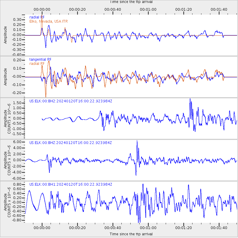
ELK Elko, Nevada, USA - Earthquake Result Viewer
*The percent match for this event was below the threshold and hence no stack was calculated.
| Earthquake location: |
Mariana Islands |
| Earthquake latitude/longitude: |
18.5/145.6 |
| Earthquake time(UTC): |
2024/01/20 (020) 15:48:41 GMT |
| Earthquake Depth: |
195 km |
| Earthquake Magnitude: |
6.1 mww |
| Earthquake Catalog/Contributor: |
NEIC PDE/us |
|
| Network: |
US United States National Seismic Network |
| Station: |
ELK Elko, Nevada, USA |
| Lat/Lon: |
40.74 N/115.24 W |
| Elevation: |
2210 m |
|
| Distance: |
84.9 deg |
| Az: |
48.857 deg |
| Baz: |
289.831 deg |
| Ray Param: |
$rayparam |
*The percent match for this event was below the threshold and hence was not used in the summary stack. |
|
| Radial Match: |
77.195816 % |
| Radial Bump: |
400 |
| Transverse Match: |
55.043842 % |
| Transverse Bump: |
400 |
| SOD ConfigId: |
33437571 |
| Insert Time: |
2024-02-03 16:15:17.107 +0000 |
| GWidth: |
2.5 |
| Max Bumps: |
400 |
| Tol: |
0.001 |
|
Signal To Noise
| Channel | StoN | STA | LTA |
| US:ELK:00:BHZ:20240120T16:00:22.923984Z | 2.9786944 | 1.1278025E-6 | 3.786231E-7 |
| US:ELK:00:BH1:20240120T16:00:22.923984Z | 0.85342246 | 3.1542024E-7 | 3.695945E-7 |
| US:ELK:00:BH2:20240120T16:00:22.923984Z | 3.2853496 | 3.6269452E-7 | 1.10397536E-7 |
| Arrivals |
| Ps | |
| PpPs | |
| PsPs/PpSs | |


