You are here: Home > Network List > TA - USArray Transportable Network (new EarthScope stations) Stations List
> Station D34A Park Rapids, MN, USA > Earthquake Result Viewer
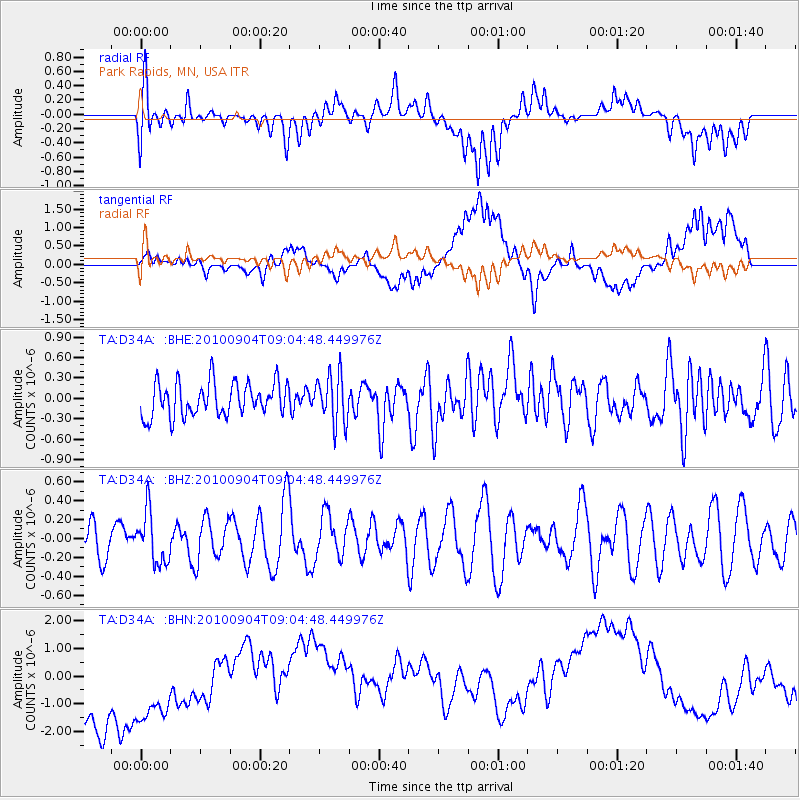
D34A Park Rapids, MN, USA - Earthquake Result Viewer
*The percent match for this event was below the threshold and hence no stack was calculated.
| Earthquake location: |
Tonga Islands |
| Earthquake latitude/longitude: |
-17.4/-174.0 |
| Earthquake time(UTC): |
2010/09/04 (247) 08:52:04 GMT |
| Earthquake Depth: |
69 km |
| Earthquake Magnitude: |
5.9 MB, 6.1 MW, 6.0 MW |
| Earthquake Catalog/Contributor: |
WHDF/NEIC |
|
| Network: |
TA USArray Transportable Network (new EarthScope stations) |
| Station: |
D34A Park Rapids, MN, USA |
| Lat/Lon: |
47.09 N/95.20 W |
| Elevation: |
476 m |
|
| Distance: |
95.2 deg |
| Az: |
42.305 deg |
| Baz: |
250.154 deg |
| Ray Param: |
$rayparam |
*The percent match for this event was below the threshold and hence was not used in the summary stack. |
|
| Radial Match: |
18.027416 % |
| Radial Bump: |
400 |
| Transverse Match: |
11.011685 % |
| Transverse Bump: |
400 |
| SOD ConfigId: |
319893 |
| Insert Time: |
2011-01-13 08:26:32.275 +0000 |
| GWidth: |
2.5 |
| Max Bumps: |
400 |
| Tol: |
0.001 |
|
Signal To Noise
| Channel | StoN | STA | LTA |
| TA:D34A: :BHZ:20100904T09:04:48.449976Z | 1.851896 | 2.691406E-7 | 1.4533245E-7 |
| TA:D34A: :BHN:20100904T09:04:48.449976Z | 0.80448115 | 2.900564E-6 | 3.6055087E-6 |
| TA:D34A: :BHE:20100904T09:04:48.449976Z | 1.4472914 | 3.5888533E-7 | 2.4797032E-7 |
| Arrivals |
| Ps | |
| PpPs | |
| PsPs/PpSs | |


