You are here: Home > Network List > UW - Pacific Northwest Regional Seismic Network Stations List
> Station IRON Crane, OR, USA > Earthquake Result Viewer
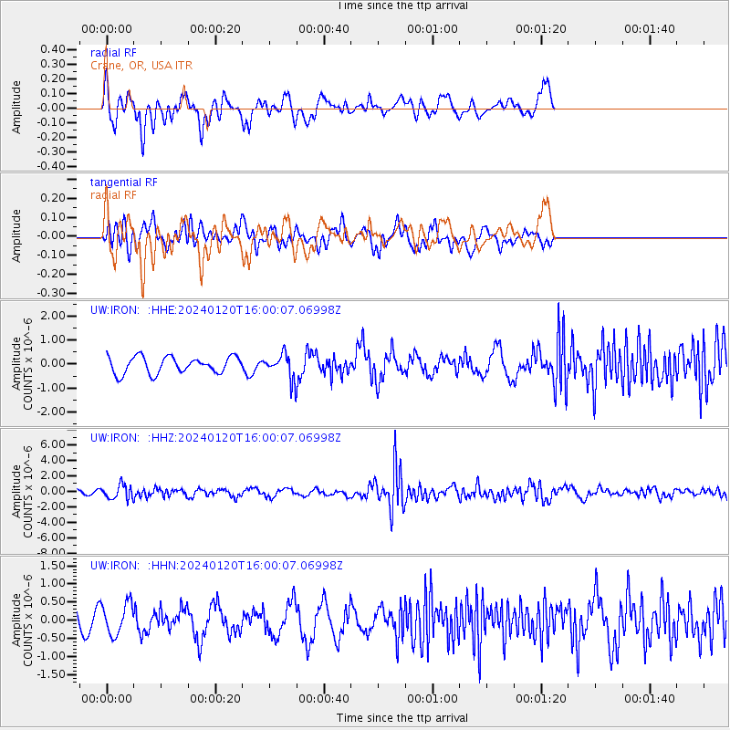
IRON Crane, OR, USA - Earthquake Result Viewer
*The percent match for this event was below the threshold and hence no stack was calculated.
| Earthquake location: |
Mariana Islands |
| Earthquake latitude/longitude: |
18.5/145.6 |
| Earthquake time(UTC): |
2024/01/20 (020) 15:48:41 GMT |
| Earthquake Depth: |
195 km |
| Earthquake Magnitude: |
6.1 mww |
| Earthquake Catalog/Contributor: |
NEIC PDE/us |
|
| Network: |
UW Pacific Northwest Regional Seismic Network |
| Station: |
IRON Crane, OR, USA |
| Lat/Lon: |
43.36 N/118.47 W |
| Elevation: |
1226 m |
|
| Distance: |
81.7 deg |
| Az: |
47.143 deg |
| Baz: |
287.471 deg |
| Ray Param: |
$rayparam |
*The percent match for this event was below the threshold and hence was not used in the summary stack. |
|
| Radial Match: |
64.68578 % |
| Radial Bump: |
400 |
| Transverse Match: |
39.025986 % |
| Transverse Bump: |
400 |
| SOD ConfigId: |
33437571 |
| Insert Time: |
2024-02-03 16:17:19.574 +0000 |
| GWidth: |
2.5 |
| Max Bumps: |
400 |
| Tol: |
0.001 |
|
Signal To Noise
| Channel | StoN | STA | LTA |
| UW:IRON: :HHZ:20240120T16:00:07.06998Z | 2.1092985 | 9.0825654E-7 | 4.305965E-7 |
| UW:IRON: :HHN:20240120T16:00:07.06998Z | 1.0857935 | 4.3694436E-7 | 4.0241937E-7 |
| UW:IRON: :HHE:20240120T16:00:07.06998Z | 1.4668114 | 5.0337474E-7 | 3.431762E-7 |
| Arrivals |
| Ps | |
| PpPs | |
| PsPs/PpSs | |


