You are here: Home > Network List > US - United States National Seismic Network Stations List
> Station HAWA Hanford, Washington, USA > Earthquake Result Viewer
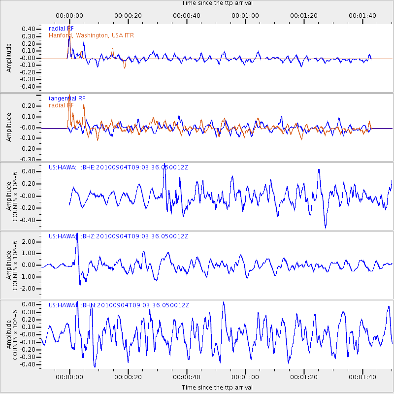
HAWA Hanford, Washington, USA - Earthquake Result Viewer
*The percent match for this event was below the threshold and hence no stack was calculated.
| Earthquake location: |
Tonga Islands |
| Earthquake latitude/longitude: |
-17.4/-174.0 |
| Earthquake time(UTC): |
2010/09/04 (247) 08:52:04 GMT |
| Earthquake Depth: |
69 km |
| Earthquake Magnitude: |
5.9 MB, 6.1 MW, 6.0 MW |
| Earthquake Catalog/Contributor: |
WHDF/NEIC |
|
| Network: |
US United States National Seismic Network |
| Station: |
HAWA Hanford, Washington, USA |
| Lat/Lon: |
46.39 N/119.53 W |
| Elevation: |
364 m |
|
| Distance: |
80.2 deg |
| Az: |
34.86 deg |
| Baz: |
232.056 deg |
| Ray Param: |
$rayparam |
*The percent match for this event was below the threshold and hence was not used in the summary stack. |
|
| Radial Match: |
76.19152 % |
| Radial Bump: |
400 |
| Transverse Match: |
81.41565 % |
| Transverse Bump: |
400 |
| SOD ConfigId: |
319893 |
| Insert Time: |
2011-01-13 08:28:22.415 +0000 |
| GWidth: |
2.5 |
| Max Bumps: |
400 |
| Tol: |
0.001 |
|
Signal To Noise
| Channel | StoN | STA | LTA |
| US:HAWA: :BHZ:20100904T09:03:36.050012Z | 6.735436 | 1.0487067E-6 | 1.5569991E-7 |
| US:HAWA: :BHN:20100904T09:03:36.050012Z | 1.5073366 | 2.0496167E-7 | 1.3597604E-7 |
| US:HAWA: :BHE:20100904T09:03:36.050012Z | 2.251578 | 1.9518045E-7 | 8.668607E-8 |
| Arrivals |
| Ps | |
| PpPs | |
| PsPs/PpSs | |


