You are here: Home > Network List > US - United States National Seismic Network Stations List
> Station DGMT Dagmar, Montana, USA > Earthquake Result Viewer
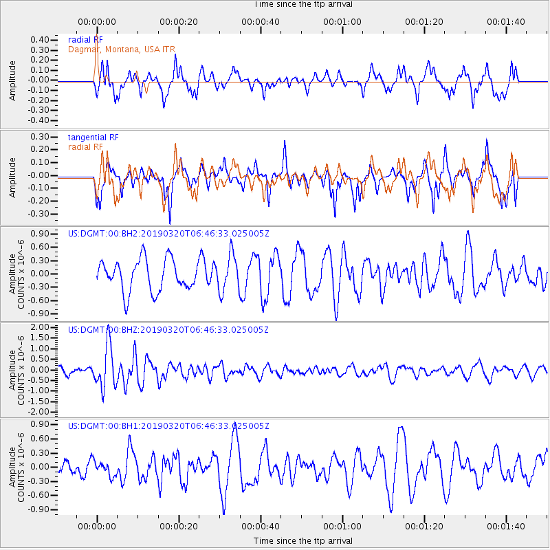
DGMT Dagmar, Montana, USA - Earthquake Result Viewer
*The percent match for this event was below the threshold and hence no stack was calculated.
| Earthquake location: |
Turkey |
| Earthquake latitude/longitude: |
37.4/29.6 |
| Earthquake time(UTC): |
2019/03/20 (079) 06:34:28 GMT |
| Earthquake Depth: |
10 km |
| Earthquake Magnitude: |
5.7 Mww |
| Earthquake Catalog/Contributor: |
NEIC PDE/us |
|
| Network: |
US United States National Seismic Network |
| Station: |
DGMT Dagmar, Montana, USA |
| Lat/Lon: |
48.47 N/104.20 W |
| Elevation: |
0.0 m |
|
| Distance: |
85.1 deg |
| Az: |
331.156 deg |
| Baz: |
35.243 deg |
| Ray Param: |
$rayparam |
*The percent match for this event was below the threshold and hence was not used in the summary stack. |
|
| Radial Match: |
60.954365 % |
| Radial Bump: |
400 |
| Transverse Match: |
66.94727 % |
| Transverse Bump: |
400 |
| SOD ConfigId: |
3338192 |
| Insert Time: |
2019-04-03 06:51:42.246 +0000 |
| GWidth: |
2.5 |
| Max Bumps: |
400 |
| Tol: |
0.001 |
|
Signal To Noise
| Channel | StoN | STA | LTA |
| US:DGMT:00:BHZ:20190320T06:46:33.025005Z | 7.4296784 | 1.0186347E-6 | 1.3710347E-7 |
| US:DGMT:00:BH1:20190320T06:46:33.025005Z | 0.59123576 | 1.492831E-7 | 2.5249335E-7 |
| US:DGMT:00:BH2:20190320T06:46:33.025005Z | 1.1850779 | 4.1593583E-7 | 3.509776E-7 |
| Arrivals |
| Ps | |
| PpPs | |
| PsPs/PpSs | |


