You are here: Home > Network List > CI - Caltech Regional Seismic Network Stations List
> Station LRL Laurel Mtn Radio Fac, Ridgecrest, CA, USA > Earthquake Result Viewer
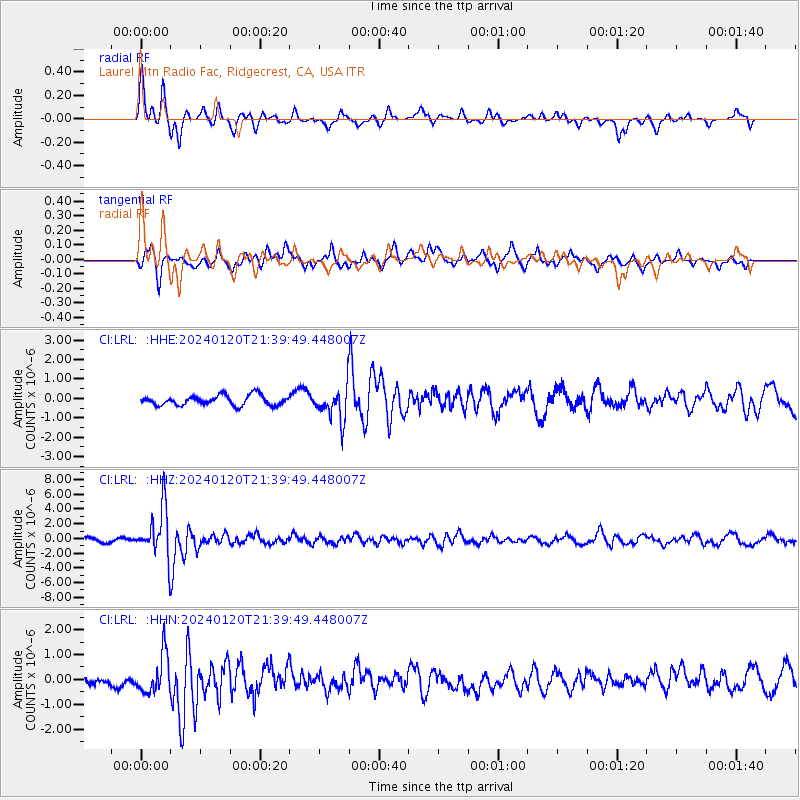
LRL Laurel Mtn Radio Fac, Ridgecrest, CA, USA - Earthquake Result Viewer
*The percent match for this event was below the threshold and hence no stack was calculated.
| Earthquake location: |
Western Brazil |
| Earthquake latitude/longitude: |
-7.3/-71.5 |
| Earthquake time(UTC): |
2024/01/20 (020) 21:31:07 GMT |
| Earthquake Depth: |
629 km |
| Earthquake Magnitude: |
6.5 Mww |
| Earthquake Catalog/Contributor: |
NEIC PDE/us |
|
| Network: |
CI Caltech Regional Seismic Network |
| Station: |
LRL Laurel Mtn Radio Fac, Ridgecrest, CA, USA |
| Lat/Lon: |
35.48 N/117.68 W |
| Elevation: |
1340 m |
|
| Distance: |
60.8 deg |
| Az: |
317.593 deg |
| Baz: |
124.95 deg |
| Ray Param: |
$rayparam |
*The percent match for this event was below the threshold and hence was not used in the summary stack. |
|
| Radial Match: |
75.60058 % |
| Radial Bump: |
335 |
| Transverse Match: |
66.461525 % |
| Transverse Bump: |
325 |
| SOD ConfigId: |
33437571 |
| Insert Time: |
2024-02-03 21:43:26.216 +0000 |
| GWidth: |
2.5 |
| Max Bumps: |
400 |
| Tol: |
0.001 |
|
Signal To Noise
| Channel | StoN | STA | LTA |
| CI:LRL: :HHZ:20240120T21:39:49.448007Z | 15.235165 | 3.3210433E-6 | 2.179854E-7 |
| CI:LRL: :HHN:20240120T21:39:49.448007Z | 3.4333978 | 7.906781E-7 | 2.3029027E-7 |
| CI:LRL: :HHE:20240120T21:39:49.448007Z | 3.370208 | 8.5069524E-7 | 2.5241624E-7 |
| Arrivals |
| Ps | |
| PpPs | |
| PsPs/PpSs | |


