You are here: Home > Network List > CI - Caltech Regional Seismic Network Stations List
> Station SWS Sam W. Stewart, Westmorland, CA, USA > Earthquake Result Viewer
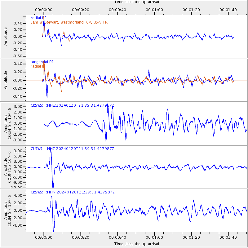
SWS Sam W. Stewart, Westmorland, CA, USA - Earthquake Result Viewer
*The percent match for this event was below the threshold and hence no stack was calculated.
| Earthquake location: |
Western Brazil |
| Earthquake latitude/longitude: |
-7.3/-71.5 |
| Earthquake time(UTC): |
2024/01/20 (020) 21:31:07 GMT |
| Earthquake Depth: |
629 km |
| Earthquake Magnitude: |
6.5 Mww |
| Earthquake Catalog/Contributor: |
NEIC PDE/us |
|
| Network: |
CI Caltech Regional Seismic Network |
| Station: |
SWS Sam W. Stewart, Westmorland, CA, USA |
| Lat/Lon: |
32.94 N/115.80 W |
| Elevation: |
140 m |
|
| Distance: |
58.1 deg |
| Az: |
316.233 deg |
| Baz: |
125.314 deg |
| Ray Param: |
$rayparam |
*The percent match for this event was below the threshold and hence was not used in the summary stack. |
|
| Radial Match: |
79.58802 % |
| Radial Bump: |
263 |
| Transverse Match: |
79.18657 % |
| Transverse Bump: |
281 |
| SOD ConfigId: |
33437571 |
| Insert Time: |
2024-02-03 21:44:07.982 +0000 |
| GWidth: |
2.5 |
| Max Bumps: |
400 |
| Tol: |
0.001 |
|
Signal To Noise
| Channel | StoN | STA | LTA |
| CI:SWS: :HHZ:20240120T21:39:31.427987Z | 17.444862 | 4.257891E-6 | 2.4407706E-7 |
| CI:SWS: :HHN:20240120T21:39:31.427987Z | 2.3781247 | 1.4458577E-6 | 6.0798226E-7 |
| CI:SWS: :HHE:20240120T21:39:31.427987Z | 5.347842 | 1.4398623E-6 | 2.6924175E-7 |
| Arrivals |
| Ps | |
| PpPs | |
| PsPs/PpSs | |


