You are here: Home > Network List > TA - USArray Transportable Network (new EarthScope stations) Stations List
> Station O03D Paynes Creek, CA, USA > Earthquake Result Viewer
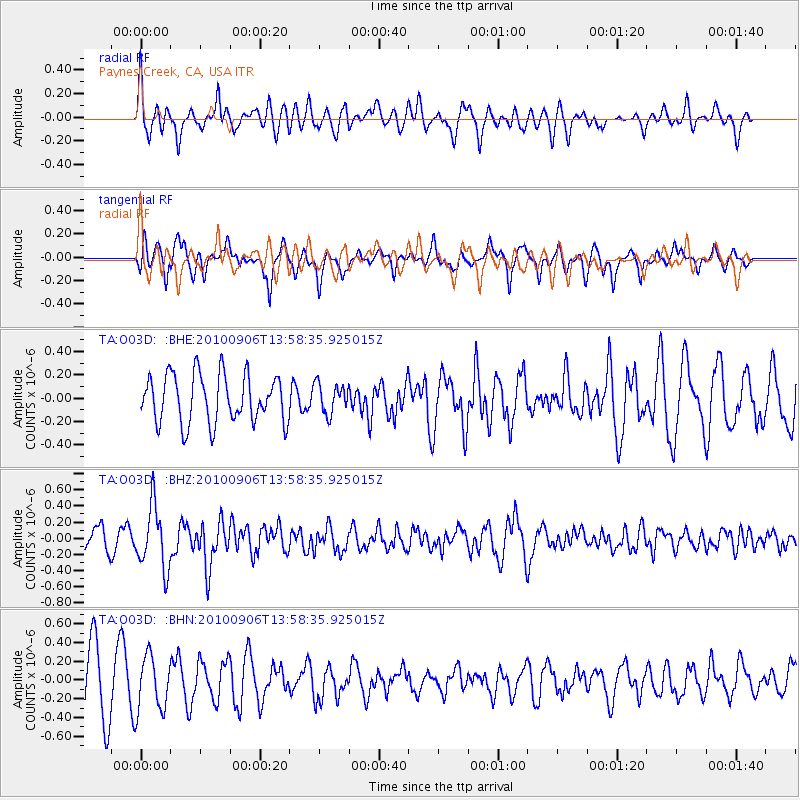
O03D Paynes Creek, CA, USA - Earthquake Result Viewer
*The percent match for this event was below the threshold and hence no stack was calculated.
| Earthquake location: |
Solomon Islands |
| Earthquake latitude/longitude: |
-11.0/162.2 |
| Earthquake time(UTC): |
2010/09/06 (249) 13:46:26 GMT |
| Earthquake Depth: |
26 km |
| Earthquake Magnitude: |
5.6 MB, 5.4 MS, 5.7 MW, 5.6 MW |
| Earthquake Catalog/Contributor: |
WHDF/NEIC |
|
| Network: |
TA USArray Transportable Network (new EarthScope stations) |
| Station: |
O03D Paynes Creek, CA, USA |
| Lat/Lon: |
40.29 N/121.80 W |
| Elevation: |
968 m |
|
| Distance: |
86.6 deg |
| Az: |
48.035 deg |
| Baz: |
252.672 deg |
| Ray Param: |
$rayparam |
*The percent match for this event was below the threshold and hence was not used in the summary stack. |
|
| Radial Match: |
57.93112 % |
| Radial Bump: |
400 |
| Transverse Match: |
55.285835 % |
| Transverse Bump: |
400 |
| SOD ConfigId: |
319893 |
| Insert Time: |
2011-01-13 08:37:33.059 +0000 |
| GWidth: |
2.5 |
| Max Bumps: |
400 |
| Tol: |
0.001 |
|
Signal To Noise
| Channel | StoN | STA | LTA |
| TA:O03D: :BHZ:20100906T13:58:35.925015Z | 3.423615 | 3.842015E-7 | 1.12220995E-7 |
| TA:O03D: :BHN:20100906T13:58:35.925015Z | 1.0097735 | 2.875588E-7 | 2.8477555E-7 |
| TA:O03D: :BHE:20100906T13:58:35.925015Z | 0.61759967 | 1.2774592E-7 | 2.0684259E-7 |
| Arrivals |
| Ps | |
| PpPs | |
| PsPs/PpSs | |


