You are here: Home > Network List > IU - Global Seismograph Network (GSN - IRIS/USGS) Stations List
> Station CTAO Charters Towers, Australia > Earthquake Result Viewer
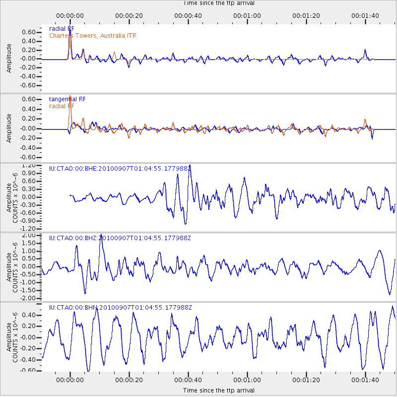
CTAO Charters Towers, Australia - Earthquake Result Viewer
*The percent match for this event was below the threshold and hence no stack was calculated.
| Earthquake location: |
Southwest Of Sumatra, Indonesia |
| Earthquake latitude/longitude: |
-6.9/103.5 |
| Earthquake time(UTC): |
2010/09/07 (250) 00:57:22 GMT |
| Earthquake Depth: |
10 km |
| Earthquake Magnitude: |
5.7 MB, 5.4 MS, 5.5 MW, 5.5 MW |
| Earthquake Catalog/Contributor: |
WHDF/NEIC |
|
| Network: |
IU Global Seismograph Network (GSN - IRIS/USGS) |
| Station: |
CTAO Charters Towers, Australia |
| Lat/Lon: |
20.09 S/146.25 E |
| Elevation: |
357 m |
|
| Distance: |
43.5 deg |
| Az: |
111.886 deg |
| Baz: |
281.429 deg |
| Ray Param: |
$rayparam |
*The percent match for this event was below the threshold and hence was not used in the summary stack. |
|
| Radial Match: |
69.427315 % |
| Radial Bump: |
396 |
| Transverse Match: |
67.79751 % |
| Transverse Bump: |
400 |
| SOD ConfigId: |
319893 |
| Insert Time: |
2011-01-13 08:40:54.349 +0000 |
| GWidth: |
2.5 |
| Max Bumps: |
400 |
| Tol: |
0.001 |
|
Signal To Noise
| Channel | StoN | STA | LTA |
| IU:CTAO:00:BHZ:20100907T01:04:55.177988Z | 2.580885 | 6.364816E-7 | 2.466137E-7 |
| IU:CTAO:00:BHN:20100907T01:04:55.177988Z | 1.6990517 | 2.758267E-7 | 1.6234154E-7 |
| IU:CTAO:00:BHE:20100907T01:04:55.177988Z | 3.6015413 | 3.6898217E-7 | 1.0245118E-7 |
| Arrivals |
| Ps | |
| PpPs | |
| PsPs/PpSs | |


