You are here: Home > Network List > TA - USArray Transportable Network (new EarthScope stations) Stations List
> Station TOLK Toolik Lake Research Station, AK, USA > Earthquake Result Viewer
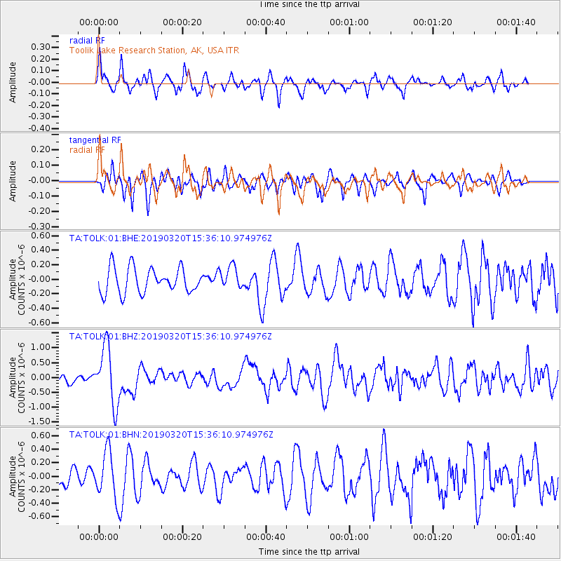
TOLK Toolik Lake Research Station, AK, USA - Earthquake Result Viewer
*The percent match for this event was below the threshold and hence no stack was calculated.
| Earthquake location: |
Vanuatu Islands |
| Earthquake latitude/longitude: |
-15.6/167.6 |
| Earthquake time(UTC): |
2019/03/20 (079) 15:23:59 GMT |
| Earthquake Depth: |
125 km |
| Earthquake Magnitude: |
6.2 Mww |
| Earthquake Catalog/Contributor: |
NEIC PDE/us |
|
| Network: |
TA USArray Transportable Network (new EarthScope stations) |
| Station: |
TOLK Toolik Lake Research Station, AK, USA |
| Lat/Lon: |
68.64 N/149.57 W |
| Elevation: |
760 m |
|
| Distance: |
89.4 deg |
| Az: |
14.419 deg |
| Baz: |
220.915 deg |
| Ray Param: |
$rayparam |
*The percent match for this event was below the threshold and hence was not used in the summary stack. |
|
| Radial Match: |
67.507675 % |
| Radial Bump: |
380 |
| Transverse Match: |
64.832275 % |
| Transverse Bump: |
400 |
| SOD ConfigId: |
3338192 |
| Insert Time: |
2019-04-03 15:28:14.810 +0000 |
| GWidth: |
2.5 |
| Max Bumps: |
400 |
| Tol: |
0.001 |
|
Signal To Noise
| Channel | StoN | STA | LTA |
| TA:TOLK:01:BHZ:20190320T15:36:10.974976Z | 7.074418 | 1.0066931E-6 | 1.4230046E-7 |
| TA:TOLK:01:BHN:20190320T15:36:10.974976Z | 2.3560324 | 3.6160796E-7 | 1.5348174E-7 |
| TA:TOLK:01:BHE:20190320T15:36:10.974976Z | 0.872515 | 1.5203379E-7 | 1.7424777E-7 |
| Arrivals |
| Ps | |
| PpPs | |
| PsPs/PpSs | |


