You are here: Home > Network List > TA - USArray Transportable Network (new EarthScope stations) Stations List
> Station I28A Midland, SD, USA > Earthquake Result Viewer
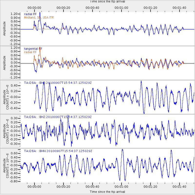
I28A Midland, SD, USA - Earthquake Result Viewer
*The percent match for this event was below the threshold and hence no stack was calculated.
| Earthquake location: |
Tajikistan-Xinjiang Border Reg. |
| Earthquake latitude/longitude: |
39.5/73.8 |
| Earthquake time(UTC): |
2010/09/07 (250) 15:41:37 GMT |
| Earthquake Depth: |
10 km |
| Earthquake Magnitude: |
5.5 MB, 5.2 MS, 5.3 MW, 5.2 MW |
| Earthquake Catalog/Contributor: |
WHDF/NEIC |
|
| Network: |
TA USArray Transportable Network (new EarthScope stations) |
| Station: |
I28A Midland, SD, USA |
| Lat/Lon: |
44.00 N/101.17 W |
| Elevation: |
655 m |
|
| Distance: |
96.8 deg |
| Az: |
356.375 deg |
| Baz: |
3.89 deg |
| Ray Param: |
$rayparam |
*The percent match for this event was below the threshold and hence was not used in the summary stack. |
|
| Radial Match: |
62.385742 % |
| Radial Bump: |
400 |
| Transverse Match: |
53.4804 % |
| Transverse Bump: |
400 |
| SOD ConfigId: |
319893 |
| Insert Time: |
2011-01-13 08:47:56.729 +0000 |
| GWidth: |
2.5 |
| Max Bumps: |
400 |
| Tol: |
0.001 |
|
Signal To Noise
| Channel | StoN | STA | LTA |
| TA:I28A: :BHZ:20100907T15:54:37.125029Z | 0.8706178 | 1.07260114E-7 | 1.232E-7 |
| TA:I28A: :BHN:20100907T15:54:37.125029Z | 1.4993058 | 2.2927966E-7 | 1.5292387E-7 |
| TA:I28A: :BHE:20100907T15:54:37.125029Z | 0.68761 | 1.7957855E-7 | 2.6116336E-7 |
| Arrivals |
| Ps | |
| PpPs | |
| PsPs/PpSs | |


