You are here: Home > Network List > TA - USArray Transportable Network (new EarthScope stations) Stations List
> Station J31A Geddes, SD, USA > Earthquake Result Viewer
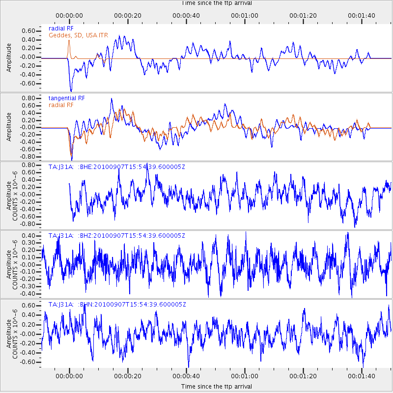
J31A Geddes, SD, USA - Earthquake Result Viewer
*The percent match for this event was below the threshold and hence no stack was calculated.
| Earthquake location: |
Tajikistan-Xinjiang Border Reg. |
| Earthquake latitude/longitude: |
39.5/73.8 |
| Earthquake time(UTC): |
2010/09/07 (250) 15:41:37 GMT |
| Earthquake Depth: |
10 km |
| Earthquake Magnitude: |
5.5 MB, 5.2 MS, 5.3 MW, 5.2 MW |
| Earthquake Catalog/Contributor: |
WHDF/NEIC |
|
| Network: |
TA USArray Transportable Network (new EarthScope stations) |
| Station: |
J31A Geddes, SD, USA |
| Lat/Lon: |
43.29 N/98.74 W |
| Elevation: |
491 m |
|
| Distance: |
97.4 deg |
| Az: |
354.544 deg |
| Baz: |
5.787 deg |
| Ray Param: |
$rayparam |
*The percent match for this event was below the threshold and hence was not used in the summary stack. |
|
| Radial Match: |
45.430187 % |
| Radial Bump: |
400 |
| Transverse Match: |
43.932594 % |
| Transverse Bump: |
400 |
| SOD ConfigId: |
319893 |
| Insert Time: |
2011-01-13 08:49:02.753 +0000 |
| GWidth: |
2.5 |
| Max Bumps: |
400 |
| Tol: |
0.001 |
|
Signal To Noise
| Channel | StoN | STA | LTA |
| TA:J31A: :BHZ:20100907T15:54:39.600005Z | 0.8098532 | 1.1178169E-7 | 1.380271E-7 |
| TA:J31A: :BHN:20100907T15:54:39.600005Z | 1.2785107 | 2.8310626E-7 | 2.214344E-7 |
| TA:J31A: :BHE:20100907T15:54:39.600005Z | 1.163315 | 3.0545382E-7 | 2.625719E-7 |
| Arrivals |
| Ps | |
| PpPs | |
| PsPs/PpSs | |


