You are here: Home > Network List > US - United States National Seismic Network Stations List
> Station WMOK Wichita Mountains, Oklahoma, USA > Earthquake Result Viewer
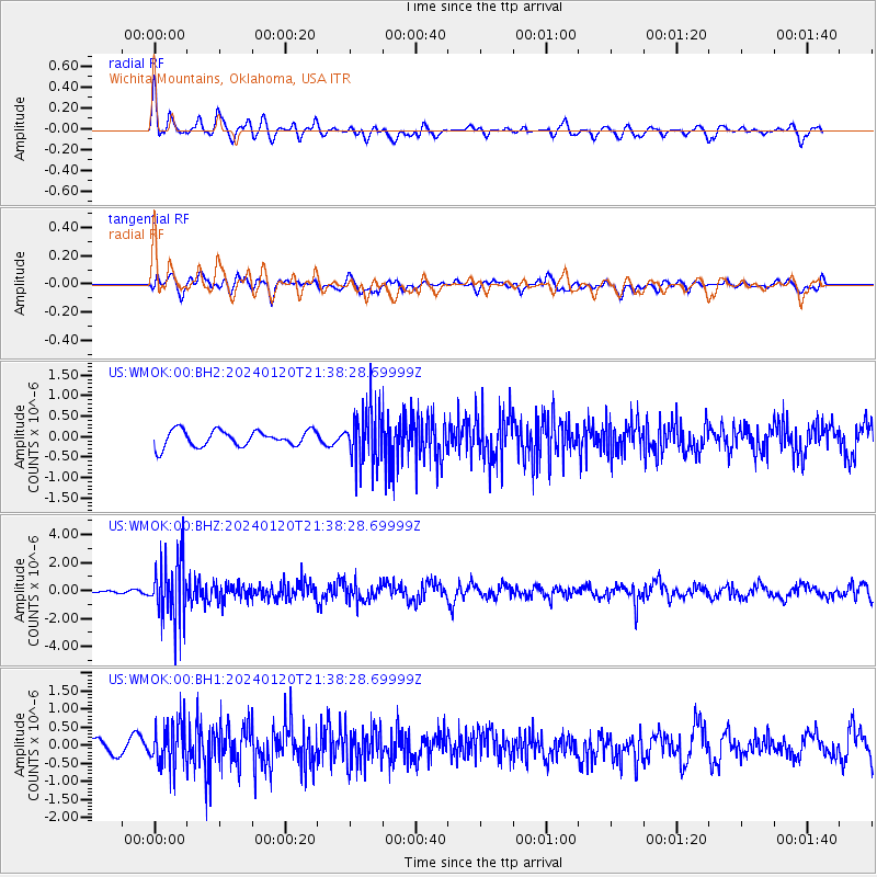
WMOK Wichita Mountains, Oklahoma, USA - Earthquake Result Viewer
*The percent match for this event was below the threshold and hence no stack was calculated.
| Earthquake location: |
Western Brazil |
| Earthquake latitude/longitude: |
-7.3/-71.5 |
| Earthquake time(UTC): |
2024/01/20 (020) 21:31:07 GMT |
| Earthquake Depth: |
629 km |
| Earthquake Magnitude: |
6.5 Mww |
| Earthquake Catalog/Contributor: |
NEIC PDE/us |
|
| Network: |
US United States National Seismic Network |
| Station: |
WMOK Wichita Mountains, Oklahoma, USA |
| Lat/Lon: |
34.74 N/98.78 W |
| Elevation: |
486 m |
|
| Distance: |
49.1 deg |
| Az: |
330.062 deg |
| Baz: |
143.05 deg |
| Ray Param: |
$rayparam |
*The percent match for this event was below the threshold and hence was not used in the summary stack. |
|
| Radial Match: |
48.33278 % |
| Radial Bump: |
400 |
| Transverse Match: |
58.964367 % |
| Transverse Bump: |
400 |
| SOD ConfigId: |
33437571 |
| Insert Time: |
2024-02-03 22:07:49.709 +0000 |
| GWidth: |
2.5 |
| Max Bumps: |
400 |
| Tol: |
0.001 |
|
Signal To Noise
| Channel | StoN | STA | LTA |
| US:WMOK:00:BHZ:20240120T21:38:28.69999Z | 10.588236 | 2.105358E-6 | 1.9883933E-7 |
| US:WMOK:00:BH1:20240120T21:38:28.69999Z | 2.4541216 | 6.079789E-7 | 2.4773786E-7 |
| US:WMOK:00:BH2:20240120T21:38:28.69999Z | 3.2977245 | 6.438655E-7 | 1.952454E-7 |
| Arrivals |
| Ps | |
| PpPs | |
| PsPs/PpSs | |


