You are here: Home > Network List > UU - University of Utah Regional Network Stations List
> Station FORU South Mineral Mountains, UT, USA > Earthquake Result Viewer
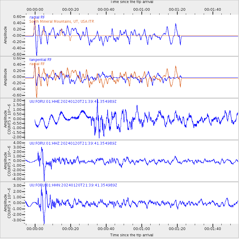
FORU South Mineral Mountains, UT, USA - Earthquake Result Viewer
*The percent match for this event was below the threshold and hence no stack was calculated.
| Earthquake location: |
Western Brazil |
| Earthquake latitude/longitude: |
-7.3/-71.5 |
| Earthquake time(UTC): |
2024/01/20 (020) 21:31:07 GMT |
| Earthquake Depth: |
629 km |
| Earthquake Magnitude: |
6.5 Mww |
| Earthquake Catalog/Contributor: |
NEIC PDE/us |
|
| Network: |
UU University of Utah Regional Network |
| Station: |
FORU South Mineral Mountains, UT, USA |
| Lat/Lon: |
38.46 N/112.86 W |
| Elevation: |
1840 m |
|
| Distance: |
59.6 deg |
| Az: |
323.024 deg |
| Baz: |
130.539 deg |
| Ray Param: |
$rayparam |
*The percent match for this event was below the threshold and hence was not used in the summary stack. |
|
| Radial Match: |
63.790104 % |
| Radial Bump: |
400 |
| Transverse Match: |
67.75785 % |
| Transverse Bump: |
368 |
| SOD ConfigId: |
33437571 |
| Insert Time: |
2024-02-03 22:08:08.396 +0000 |
| GWidth: |
2.5 |
| Max Bumps: |
400 |
| Tol: |
0.001 |
|
Signal To Noise
| Channel | StoN | STA | LTA |
| UU:FORU:01:HHZ:20240120T21:39:41.354989Z | 5.765548 | 1.1737606E-6 | 2.0358178E-7 |
| UU:FORU:01:HHN:20240120T21:39:41.354989Z | 3.1094034 | 9.163319E-7 | 2.94697E-7 |
| UU:FORU:01:HHE:20240120T21:39:41.354989Z | 1.4028335 | 5.784648E-7 | 4.1235455E-7 |
| Arrivals |
| Ps | |
| PpPs | |
| PsPs/PpSs | |


