You are here: Home > Network List > UW - Pacific Northwest Regional Seismic Network Stations List
> Station IRON Crane, OR, USA > Earthquake Result Viewer
IRON Crane, OR, USA - Earthquake Result Viewer
*The percent match for this event was below the threshold and hence no stack was calculated.
| Earthquake location: |
Western Brazil |
| Earthquake latitude/longitude: |
-7.3/-71.5 |
| Earthquake time(UTC): |
2024/01/20 (020) 21:31:07 GMT |
| Earthquake Depth: |
629 km |
| Earthquake Magnitude: |
6.5 Mww |
| Earthquake Catalog/Contributor: |
NEIC PDE/us |
|
| Network: |
UW Pacific Northwest Regional Seismic Network |
| Station: |
IRON Crane, OR, USA |
| Lat/Lon: |
43.36 N/118.47 W |
| Elevation: |
1226 m |
|
| Distance: |
66.0 deg |
| Az: |
324.287 deg |
| Baz: |
127.45 deg |
| Ray Param: |
$rayparam |
*The percent match for this event was below the threshold and hence was not used in the summary stack. |
|
| Radial Match: |
58.60711 % |
| Radial Bump: |
400 |
| Transverse Match: |
59.010197 % |
| Transverse Bump: |
400 |
| SOD ConfigId: |
33437571 |
| Insert Time: |
2024-02-03 22:09:54.370 +0000 |
| GWidth: |
2.5 |
| Max Bumps: |
400 |
| Tol: |
0.001 |
|
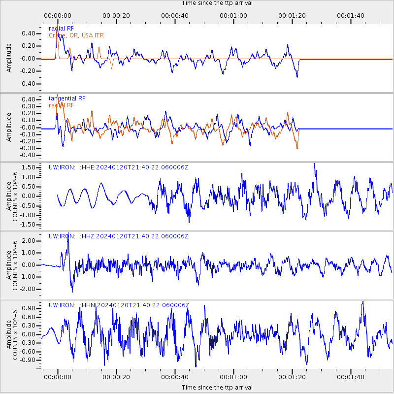
Signal To Noise
| Channel | StoN | STA | LTA |
| UW:IRON: :HHZ:20240120T21:40:22.060006Z | 2.4508874 | 9.704028E-7 | 3.9593937E-7 |
| UW:IRON: :HHN:20240120T21:40:22.060006Z | 1.1402061 | 3.193617E-7 | 2.8009123E-7 |
| UW:IRON: :HHE:20240120T21:40:22.060006Z | 1.2446388 | 4.090119E-7 | 3.2861894E-7 |
| Arrivals |
| Ps | |
| PpPs | |
| PsPs/PpSs | |


