You are here: Home > Network List > UW - Pacific Northwest Regional Seismic Network Stations List
> Station UMAT Pilot Rock, OR, USA > Earthquake Result Viewer
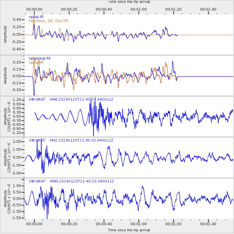
UMAT Pilot Rock, OR, USA - Earthquake Result Viewer
*The percent match for this event was below the threshold and hence no stack was calculated.
| Earthquake location: |
Western Brazil |
| Earthquake latitude/longitude: |
-7.3/-71.5 |
| Earthquake time(UTC): |
2024/01/20 (020) 21:31:07 GMT |
| Earthquake Depth: |
629 km |
| Earthquake Magnitude: |
6.5 Mww |
| Earthquake Catalog/Contributor: |
NEIC PDE/us |
|
| Network: |
UW Pacific Northwest Regional Seismic Network |
| Station: |
UMAT Pilot Rock, OR, USA |
| Lat/Lon: |
45.29 N/118.96 W |
| Elevation: |
1318 m |
|
| Distance: |
67.4 deg |
| Az: |
325.723 deg |
| Baz: |
127.68 deg |
| Ray Param: |
$rayparam |
*The percent match for this event was below the threshold and hence was not used in the summary stack. |
|
| Radial Match: |
46.373924 % |
| Radial Bump: |
386 |
| Transverse Match: |
60.234142 % |
| Transverse Bump: |
346 |
| SOD ConfigId: |
33437571 |
| Insert Time: |
2024-02-03 22:11:21.030 +0000 |
| GWidth: |
2.5 |
| Max Bumps: |
400 |
| Tol: |
0.001 |
|
Signal To Noise
| Channel | StoN | STA | LTA |
| UW:UMAT: :HHZ:20240120T21:40:30.940011Z | 2.25316 | 7.67248E-7 | 3.405209E-7 |
| UW:UMAT: :HHN:20240120T21:40:30.940011Z | 2.7751884 | 4.2797262E-7 | 1.542139E-7 |
| UW:UMAT: :HHE:20240120T21:40:30.940011Z | 2.7773151 | 5.639205E-7 | 2.0304519E-7 |
| Arrivals |
| Ps | |
| PpPs | |
| PsPs/PpSs | |


