You are here: Home > Network List > TA - USArray Transportable Network (new EarthScope stations) Stations List
> Station S26A Kim, CO, USA > Earthquake Result Viewer
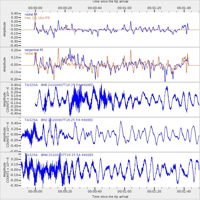
S26A Kim, CO, USA - Earthquake Result Viewer
*The percent match for this event was below the threshold and hence no stack was calculated.
| Earthquake location: |
Fiji Islands Region |
| Earthquake latitude/longitude: |
-15.9/-179.3 |
| Earthquake time(UTC): |
2010/09/07 (250) 16:13:32 GMT |
| Earthquake Depth: |
10 km |
| Earthquake Magnitude: |
5.7 MB, 6.0 MS, 6.3 MW, 6.2 MW |
| Earthquake Catalog/Contributor: |
WHDF/NEIC |
|
| Network: |
TA USArray Transportable Network (new EarthScope stations) |
| Station: |
S26A Kim, CO, USA |
| Lat/Lon: |
37.62 N/103.47 W |
| Elevation: |
1394 m |
|
| Distance: |
88.8 deg |
| Az: |
50.361 deg |
| Baz: |
248.952 deg |
| Ray Param: |
$rayparam |
*The percent match for this event was below the threshold and hence was not used in the summary stack. |
|
| Radial Match: |
41.703663 % |
| Radial Bump: |
400 |
| Transverse Match: |
58.190025 % |
| Transverse Bump: |
400 |
| SOD ConfigId: |
319893 |
| Insert Time: |
2011-01-13 08:56:05.648 +0000 |
| GWidth: |
2.5 |
| Max Bumps: |
400 |
| Tol: |
0.001 |
|
Signal To Noise
| Channel | StoN | STA | LTA |
| TA:S26A: :BHZ:20100907T16:25:54.44998Z | 1.8608902 | 1.7084074E-7 | 9.180592E-8 |
| TA:S26A: :BHN:20100907T16:25:54.44998Z | 1.1819776 | 1.0959104E-7 | 9.2718366E-8 |
| TA:S26A: :BHE:20100907T16:25:54.44998Z | 0.8651076 | 1.459603E-7 | 1.6871925E-7 |
| Arrivals |
| Ps | |
| PpPs | |
| PsPs/PpSs | |


