You are here: Home > Network List > TA - USArray Transportable Network (new EarthScope stations) Stations List
> Station S31A Mullinville, KS, USA > Earthquake Result Viewer
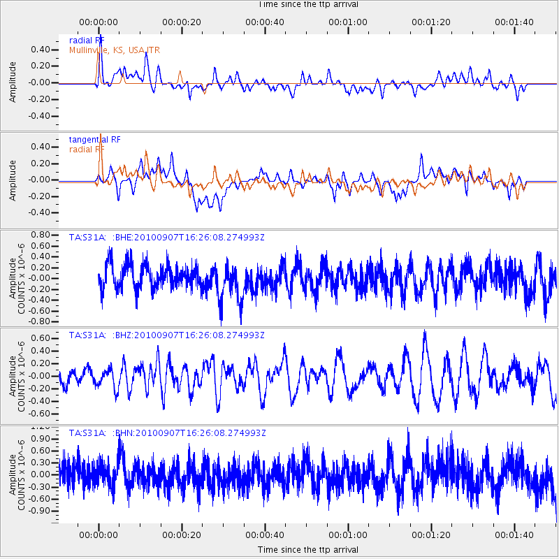
S31A Mullinville, KS, USA - Earthquake Result Viewer
*The percent match for this event was below the threshold and hence no stack was calculated.
| Earthquake location: |
Fiji Islands Region |
| Earthquake latitude/longitude: |
-15.9/-179.3 |
| Earthquake time(UTC): |
2010/09/07 (250) 16:13:32 GMT |
| Earthquake Depth: |
10 km |
| Earthquake Magnitude: |
5.7 MB, 6.0 MS, 6.3 MW, 6.2 MW |
| Earthquake Catalog/Contributor: |
WHDF/NEIC |
|
| Network: |
TA USArray Transportable Network (new EarthScope stations) |
| Station: |
S31A Mullinville, KS, USA |
| Lat/Lon: |
37.62 N/99.48 W |
| Elevation: |
700 m |
|
| Distance: |
91.7 deg |
| Az: |
51.437 deg |
| Baz: |
251.372 deg |
| Ray Param: |
$rayparam |
*The percent match for this event was below the threshold and hence was not used in the summary stack. |
|
| Radial Match: |
63.17571 % |
| Radial Bump: |
400 |
| Transverse Match: |
46.987553 % |
| Transverse Bump: |
400 |
| SOD ConfigId: |
319893 |
| Insert Time: |
2011-01-13 08:56:57.051 +0000 |
| GWidth: |
2.5 |
| Max Bumps: |
400 |
| Tol: |
0.001 |
|
Signal To Noise
| Channel | StoN | STA | LTA |
| TA:S31A: :BHZ:20100907T16:26:08.274993Z | 1.0009234 | 1.5564918E-7 | 1.5550557E-7 |
| TA:S31A: :BHN:20100907T16:26:08.274993Z | 1.030062 | 3.1323137E-7 | 3.040898E-7 |
| TA:S31A: :BHE:20100907T16:26:08.274993Z | 1.7751441 | 3.8881117E-7 | 2.1903077E-7 |
| Arrivals |
| Ps | |
| PpPs | |
| PsPs/PpSs | |


