You are here: Home > Network List > US - United States National Seismic Network Stations List
> Station MNTX Cornudas Mountains, Texas, USA > Earthquake Result Viewer
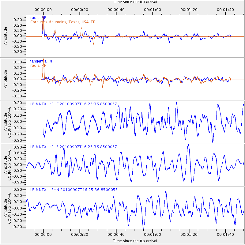
MNTX Cornudas Mountains, Texas, USA - Earthquake Result Viewer
*The percent match for this event was below the threshold and hence no stack was calculated.
| Earthquake location: |
Fiji Islands Region |
| Earthquake latitude/longitude: |
-15.9/-179.3 |
| Earthquake time(UTC): |
2010/09/07 (250) 16:13:32 GMT |
| Earthquake Depth: |
10 km |
| Earthquake Magnitude: |
5.7 MB, 6.0 MS, 6.3 MW, 6.2 MW |
| Earthquake Catalog/Contributor: |
WHDF/NEIC |
|
| Network: |
US United States National Seismic Network |
| Station: |
MNTX Cornudas Mountains, Texas, USA |
| Lat/Lon: |
31.70 N/105.38 W |
| Elevation: |
404 m |
|
| Distance: |
85.1 deg |
| Az: |
55.289 deg |
| Baz: |
248.132 deg |
| Ray Param: |
$rayparam |
*The percent match for this event was below the threshold and hence was not used in the summary stack. |
|
| Radial Match: |
68.91363 % |
| Radial Bump: |
400 |
| Transverse Match: |
62.041042 % |
| Transverse Bump: |
400 |
| SOD ConfigId: |
319893 |
| Insert Time: |
2011-01-13 09:01:35.137 +0000 |
| GWidth: |
2.5 |
| Max Bumps: |
400 |
| Tol: |
0.001 |
|
Signal To Noise
| Channel | StoN | STA | LTA |
| US:MNTX: :BHZ:20100907T16:25:36.850005Z | 2.5888317 | 2.1860326E-7 | 8.444089E-8 |
| US:MNTX: :BHN:20100907T16:25:36.850005Z | 0.7963053 | 4.5831282E-8 | 5.7554914E-8 |
| US:MNTX: :BHE:20100907T16:25:36.850005Z | 1.070953 | 1.1448647E-7 | 1.0690148E-7 |
| Arrivals |
| Ps | |
| PpPs | |
| PsPs/PpSs | |


