You are here: Home > Network List > TA - USArray Transportable Network (new EarthScope stations) Stations List
> Station R11A Troy Canyon, Currant, NV, USA > Earthquake Result Viewer
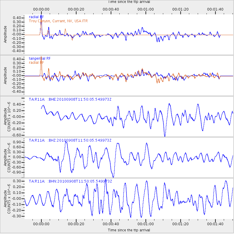
R11A Troy Canyon, Currant, NV, USA - Earthquake Result Viewer
*The percent match for this event was below the threshold and hence no stack was calculated.
| Earthquake location: |
Vanuatu Islands |
| Earthquake latitude/longitude: |
-20.7/169.8 |
| Earthquake time(UTC): |
2010/09/08 (251) 11:37:31 GMT |
| Earthquake Depth: |
10 km |
| Earthquake Magnitude: |
5.9 MB, 6.2 MS, 6.3 MW, 6.3 MW |
| Earthquake Catalog/Contributor: |
WHDF/NEIC |
|
| Network: |
TA USArray Transportable Network (new EarthScope stations) |
| Station: |
R11A Troy Canyon, Currant, NV, USA |
| Lat/Lon: |
38.35 N/115.59 W |
| Elevation: |
1756 m |
|
| Distance: |
91.2 deg |
| Az: |
49.306 deg |
| Baz: |
244.551 deg |
| Ray Param: |
$rayparam |
*The percent match for this event was below the threshold and hence was not used in the summary stack. |
|
| Radial Match: |
75.99048 % |
| Radial Bump: |
400 |
| Transverse Match: |
70.52754 % |
| Transverse Bump: |
400 |
| SOD ConfigId: |
319893 |
| Insert Time: |
2011-01-13 09:09:46.077 +0000 |
| GWidth: |
2.5 |
| Max Bumps: |
400 |
| Tol: |
0.001 |
|
Signal To Noise
| Channel | StoN | STA | LTA |
| TA:R11A: :BHZ:20100908T11:50:05.549973Z | 1.1968435 | 1.4975824E-7 | 1.2512767E-7 |
| TA:R11A: :BHN:20100908T11:50:05.549973Z | 1.0981648 | 8.840795E-8 | 8.0505174E-8 |
| TA:R11A: :BHE:20100908T11:50:05.549973Z | 1.5469114 | 1.7714903E-7 | 1.14517896E-7 |
| Arrivals |
| Ps | |
| PpPs | |
| PsPs/PpSs | |


