You are here: Home > Network List > US - United States National Seismic Network Stations List
> Station HAWA Hanford, Washington, USA > Earthquake Result Viewer
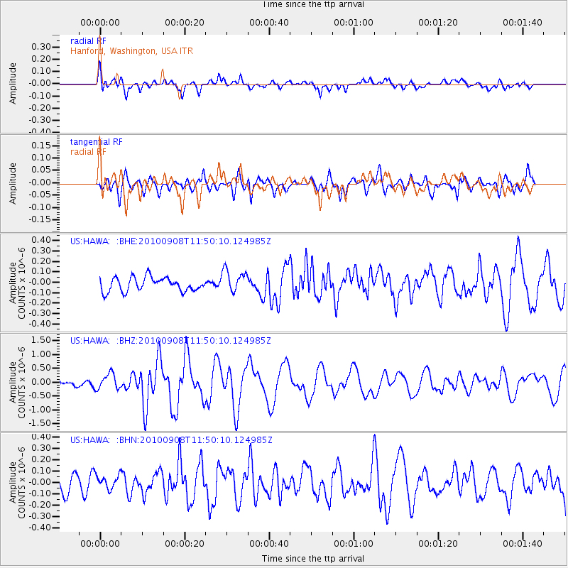
HAWA Hanford, Washington, USA - Earthquake Result Viewer
*The percent match for this event was below the threshold and hence no stack was calculated.
| Earthquake location: |
Vanuatu Islands |
| Earthquake latitude/longitude: |
-20.7/169.8 |
| Earthquake time(UTC): |
2010/09/08 (251) 11:37:31 GMT |
| Earthquake Depth: |
10 km |
| Earthquake Magnitude: |
5.9 MB, 6.2 MS, 6.3 MW, 6.3 MW |
| Earthquake Catalog/Contributor: |
WHDF/NEIC |
|
| Network: |
US United States National Seismic Network |
| Station: |
HAWA Hanford, Washington, USA |
| Lat/Lon: |
46.39 N/119.53 W |
| Elevation: |
364 m |
|
| Distance: |
92.2 deg |
| Az: |
40.808 deg |
| Baz: |
242.148 deg |
| Ray Param: |
$rayparam |
*The percent match for this event was below the threshold and hence was not used in the summary stack. |
|
| Radial Match: |
70.763374 % |
| Radial Bump: |
400 |
| Transverse Match: |
70.60233 % |
| Transverse Bump: |
400 |
| SOD ConfigId: |
319893 |
| Insert Time: |
2011-01-13 09:11:06.731 +0000 |
| GWidth: |
2.5 |
| Max Bumps: |
400 |
| Tol: |
0.001 |
|
Signal To Noise
| Channel | StoN | STA | LTA |
| US:HAWA: :BHZ:20100908T11:50:10.124985Z | 3.4439564 | 2.830999E-7 | 8.220194E-8 |
| US:HAWA: :BHN:20100908T11:50:10.124985Z | 0.92414343 | 5.759678E-8 | 6.23245E-8 |
| US:HAWA: :BHE:20100908T11:50:10.124985Z | 1.6772641 | 1.0977439E-7 | 6.544848E-8 |
| Arrivals |
| Ps | |
| PpPs | |
| PsPs/PpSs | |


