You are here: Home > Network List > CI - Caltech Regional Seismic Network Stations List
> Station BAR Barrett, Tecate, CA, USA > Earthquake Result Viewer
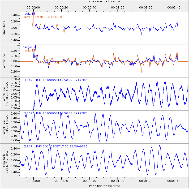
BAR Barrett, Tecate, CA, USA - Earthquake Result Viewer
*The percent match for this event was below the threshold and hence no stack was calculated.
| Earthquake location: |
Kuril Islands |
| Earthquake latitude/longitude: |
44.6/149.7 |
| Earthquake time(UTC): |
2010/09/08 (251) 17:39:40 GMT |
| Earthquake Depth: |
10 km |
| Earthquake Magnitude: |
5.5 MB, 5.3 MS, 5.5 MW |
| Earthquake Catalog/Contributor: |
WHDF/NEIC |
|
| Network: |
CI Caltech Regional Seismic Network |
| Station: |
BAR Barrett, Tecate, CA, USA |
| Lat/Lon: |
32.68 N/116.67 W |
| Elevation: |
521 m |
|
| Distance: |
70.2 deg |
| Az: |
63.423 deg |
| Baz: |
310.736 deg |
| Ray Param: |
$rayparam |
*The percent match for this event was below the threshold and hence was not used in the summary stack. |
|
| Radial Match: |
51.49246 % |
| Radial Bump: |
400 |
| Transverse Match: |
42.49726 % |
| Transverse Bump: |
400 |
| SOD ConfigId: |
319893 |
| Insert Time: |
2011-01-13 09:14:42.605 +0000 |
| GWidth: |
2.5 |
| Max Bumps: |
400 |
| Tol: |
0.001 |
|
Signal To Noise
| Channel | StoN | STA | LTA |
| CI:BAR: :BHZ:20100908T17:50:22.394978Z | 1.6832051 | 4.3834322E-7 | 2.6042173E-7 |
| CI:BAR: :BHN:20100908T17:50:22.394978Z | 1.1866959 | 2.3474311E-7 | 1.9781235E-7 |
| CI:BAR: :BHE:20100908T17:50:22.394978Z | 0.8377932 | 6.103577E-8 | 7.285303E-8 |
| Arrivals |
| Ps | |
| PpPs | |
| PsPs/PpSs | |


