You are here: Home > Network List > US - United States National Seismic Network Stations List
> Station DUG Dugway, Tooele County, Utah, USA > Earthquake Result Viewer
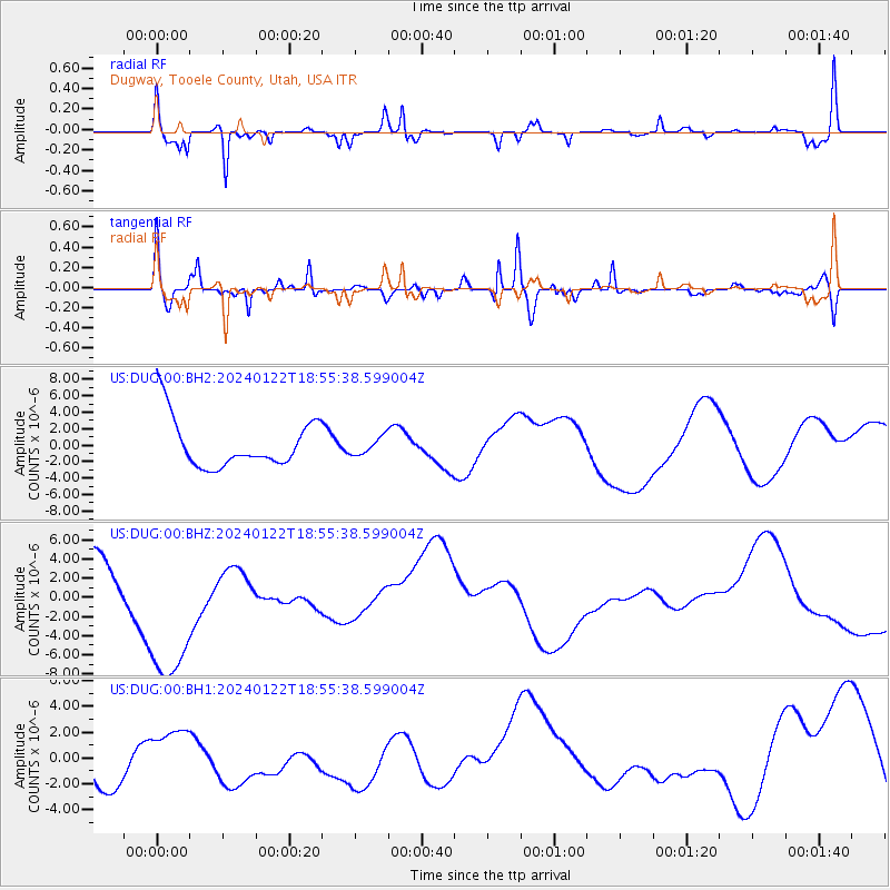
DUG Dugway, Tooele County, Utah, USA - Earthquake Result Viewer
*The percent match for this event was below the threshold and hence no stack was calculated.
| Earthquake location: |
Kyrgyzstan-Xinjiang Border Reg. |
| Earthquake latitude/longitude: |
41.3/78.8 |
| Earthquake time(UTC): |
2024/01/22 (022) 18:42:33 GMT |
| Earthquake Depth: |
10 km |
| Earthquake Magnitude: |
5.5 mb |
| Earthquake Catalog/Contributor: |
NEIC PDE/us |
|
| Network: |
US United States National Seismic Network |
| Station: |
DUG Dugway, Tooele County, Utah, USA |
| Lat/Lon: |
40.19 N/112.81 W |
| Elevation: |
1477 m |
|
| Distance: |
98.2 deg |
| Az: |
8.938 deg |
| Baz: |
351.214 deg |
| Ray Param: |
$rayparam |
*The percent match for this event was below the threshold and hence was not used in the summary stack. |
|
| Radial Match: |
55.128963 % |
| Radial Bump: |
323 |
| Transverse Match: |
58.88075 % |
| Transverse Bump: |
400 |
| SOD ConfigId: |
33437571 |
| Insert Time: |
2024-02-05 19:09:01.238 +0000 |
| GWidth: |
2.5 |
| Max Bumps: |
400 |
| Tol: |
0.001 |
|
Signal To Noise
| Channel | StoN | STA | LTA |
| US:DUG:00:BHZ:20240122T18:55:38.599004Z | 4.7413535 | 9.25637E-6 | 1.9522631E-6 |
| US:DUG:00:BH1:20240122T18:55:38.599004Z | 0.6063815 | 2.1107542E-6 | 3.4809016E-6 |
| US:DUG:00:BH2:20240122T18:55:38.599004Z | 0.3514998 | 1.0386725E-6 | 2.954973E-6 |
| Arrivals |
| Ps | |
| PpPs | |
| PsPs/PpSs | |


